Atlas login

What is a Smart City?
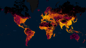
Continuous rapid urbanization is intensifying social problems in cities. Municipal governments are becoming more aware of the need to collect and manage data to enable evidence-based decision making. Smart city projects have emerged as a new alternative to address these challenges. While various definitions exist, a smart city’s general purpose is to improve its inhabitants’ quality of life and achieve sustainability objectives through the use of data and innovative technologies.
Compared to “regular” cities, smart cities often display more efficient and higher-quality public services, greater citizen participation, and resilience in the face of adversity. The Internet of Things (IoT) technologies, including sensor networks and related data analytics, provide actionable real-time insights for decision-makers in smart cities.
The major domains of smart city projects include mobility, energy, safety, security, governance, healthcare, and education. Some common examples of smart cities are
- Singapore
- Barcelona in Spain
- Busan in South Korea.
Smart City Solutions
Smart Public Safety
A city’s ability to protect citizens from natural and human-made emergencies is essential to keeping life and properties safe. At Kontur, we help our clients and partners prepare for and effectively respond to risks of natural disasters and incidents caused by humans, such as city fires.
Emergency preparedness tool
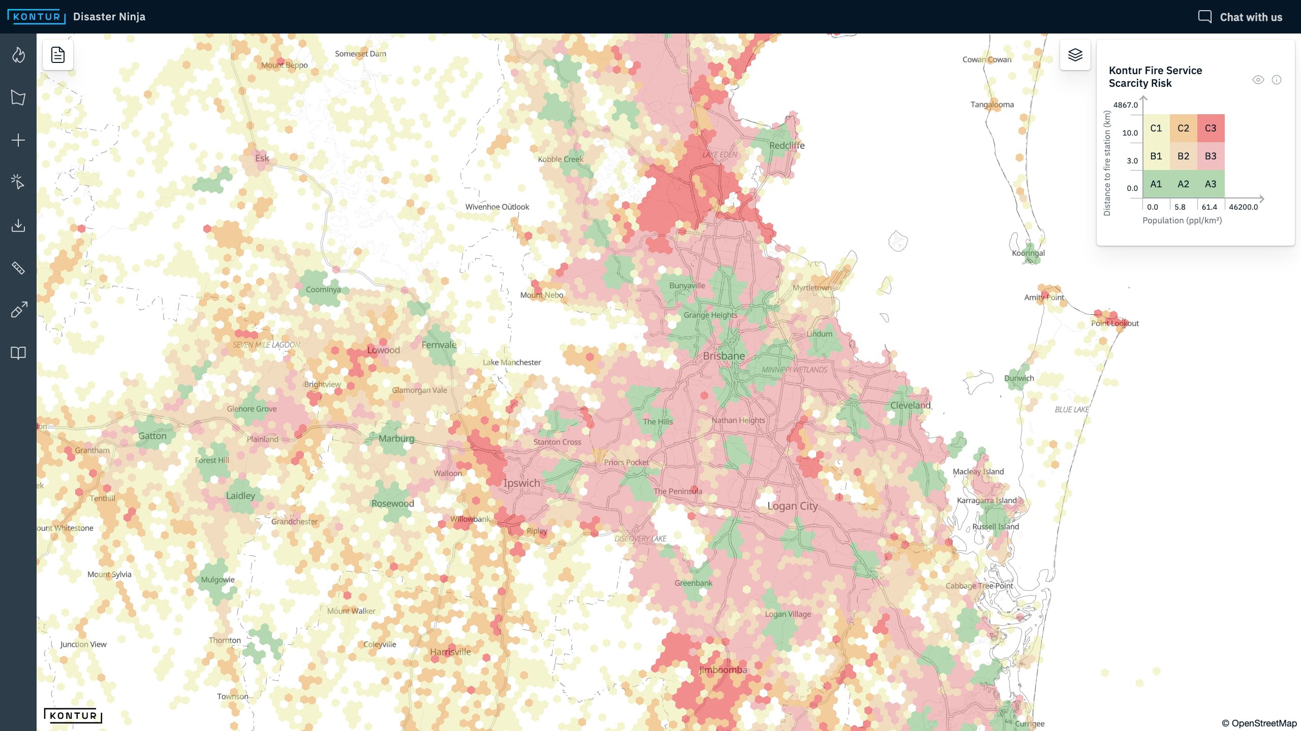
To ensure a city’s preparedness for fires, governments and municipal authorities must properly locate fire stations and determine where they lack coverage. Kontur uses its geospatial platform’s capabilities to provide insights into potential fire service scarcity and optimal fire department locations. Read more about how we do it in our blog post.
We also produce other risk maps for city authorities to optimize the coverage of various urban services.
Contact us if you need a custom solution to address your policy challenges.
Emergency responsetool
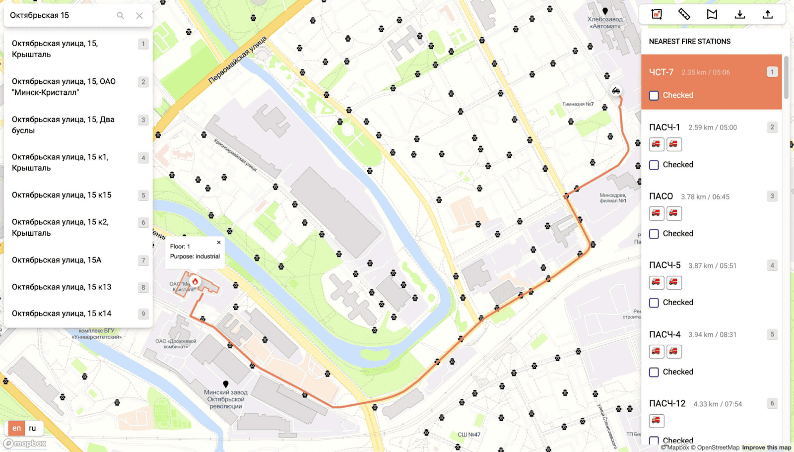
Kontur’s Dispatcher 112 app helps dispatchers locate the closest fire stations and send firefighters faster to the emergency scene. The tool contains a search engine providing a typo-proof address search (Geocoder), and we can adapt it to any call center service. A situational dashboard can be created and customized to your organization’s needs.
Disaster early warning and loss estimation tool
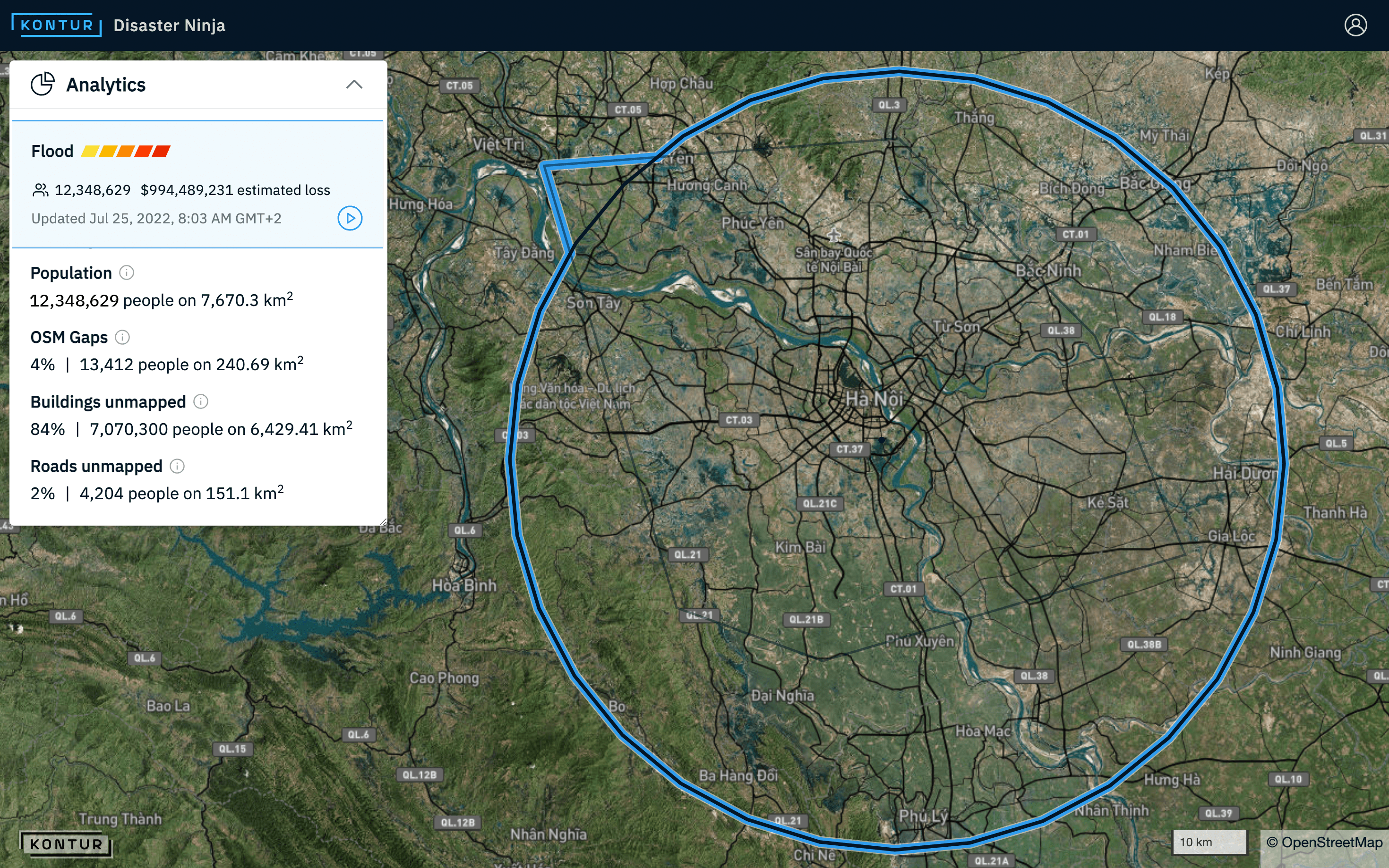
For cities located in disaster-prone regions, smart safety is also about early detection and warning systems. You can use Kontur Event Feed to obtain near real-time information from reliable sources about natural disasters such as hurricanes, floods, wildfires, and other hazards approaching the city. For each disaster event, you will learn about its type, severity, geometry, and multiple other indicators to help you make better and faster decisions in the face of an emergency. The Event Feed can serve as part of a public notification system to provide early warning to the residents of a city.
Furthermore, we include data on estimated disaster loss from each event for our commercial clients. Our machine learning algorithm computes monetary loss based on statistical data using Kontur Platform capabilities. The Disaster Loss Estimation model is becoming a powerful tool for simulating the impact of critical events and assessing insurance risks.
Smart Mobility solutions
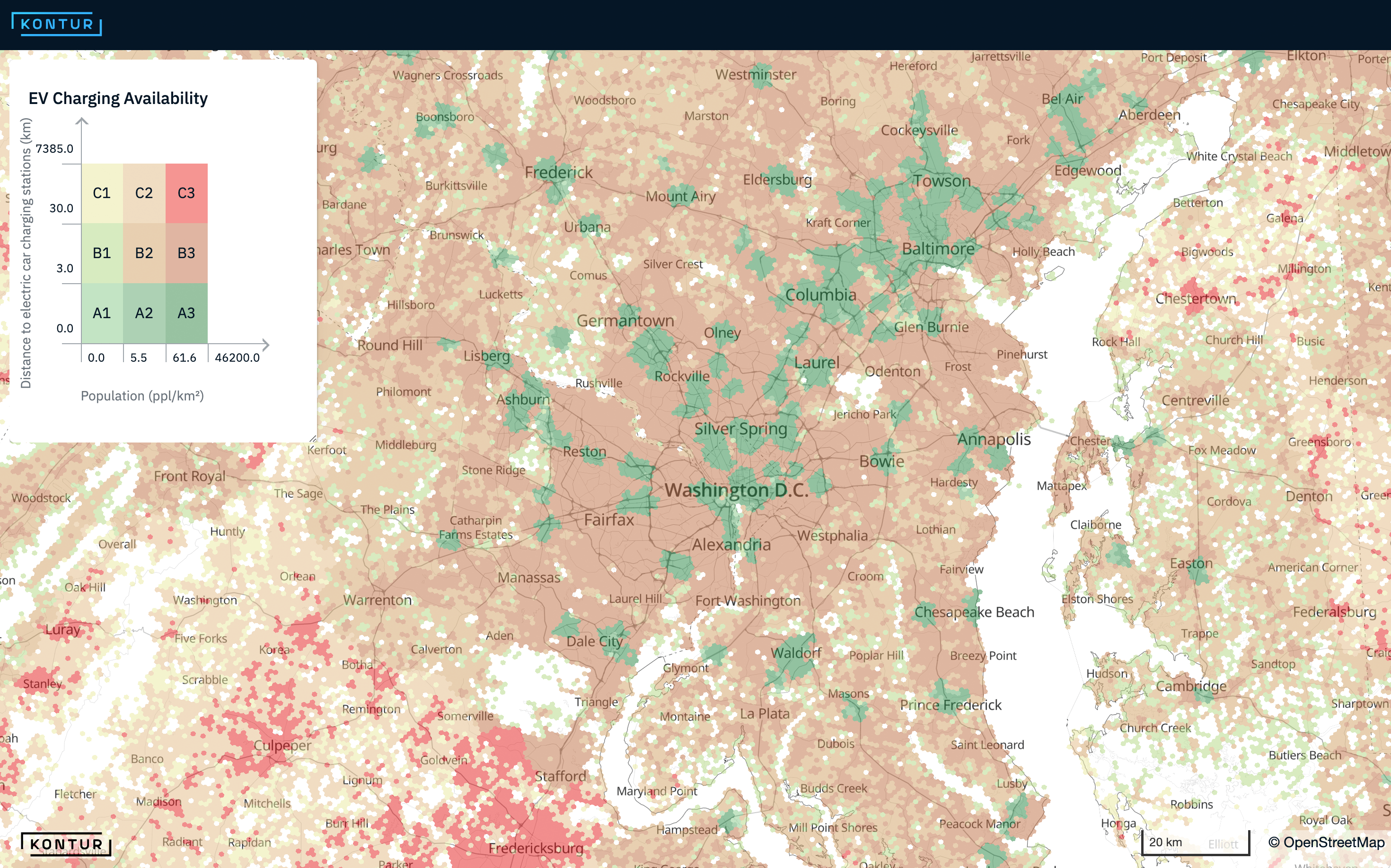
While cities are reorienting themselves around green energy supply, carmakers and consumers alike are increasing their interest in electric vehicles (EVs). With the growing volume of EVs on city roads, ensuring a sufficient charging infrastructure becomes more challenging. Kontur’s geospatial solutions can help city planners and other parties optimize the placement of new EV charging points.
We have combined publicly available data on where charging points are already present and the minimum range of fully electric cars to produce a new analytical layer on Disaster Ninja. It allows you to assess charger availability in a particular area and identify potential spots for building new stations. For commercial clients, we increase the accuracy of the present EV charging network with proprietary data sources.
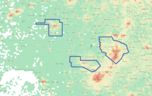
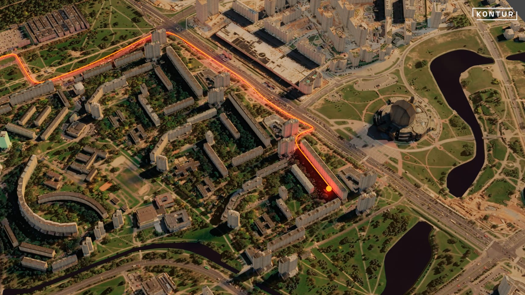
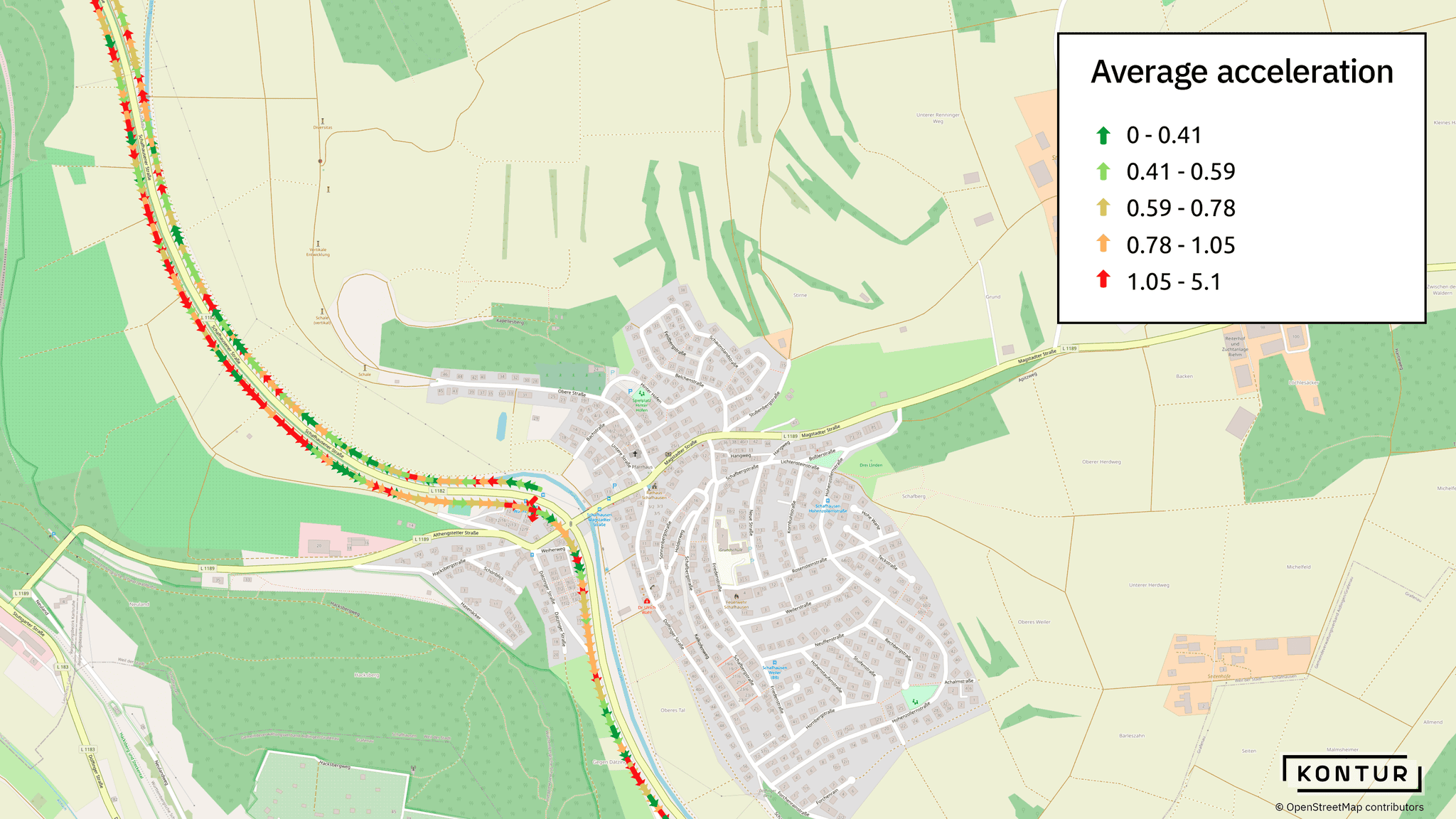
Road authorities can test road quality using a custom map based on data from car accelerometers. The green arrows on the map below indicate road sections with the lowest standard deviation of accelerometer data. The red arrows correspond to active accelerometer shaking and low road coverage quality. Governments can use this tool to understand when and where to fund road maintenance and upgrades.
15 minute smart cities
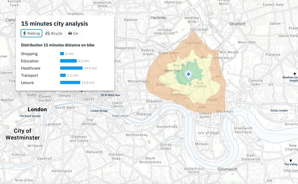
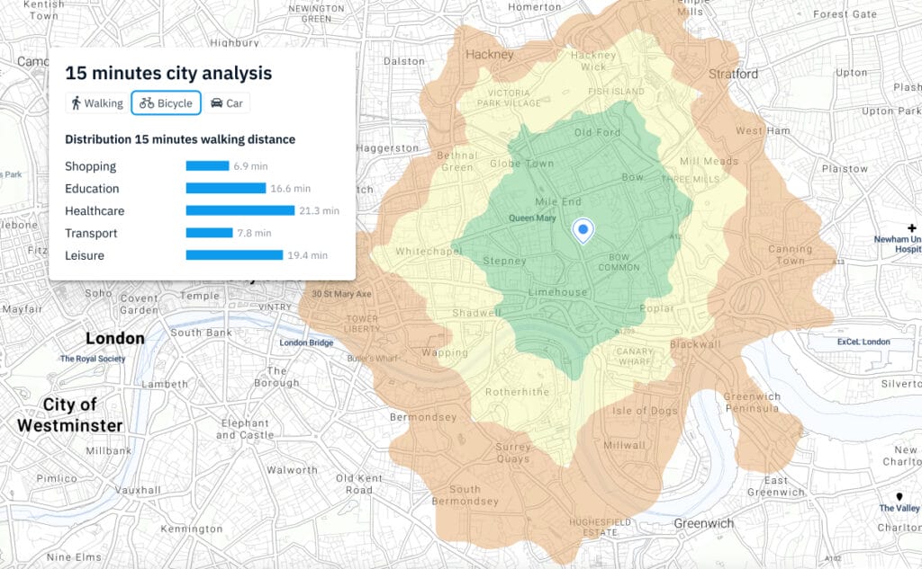
Most daily necessities and services, such shopping, education, healthcare, transport, leisure and others should be easily reached by a 15-minute walk or a bike ride from any point in the city.
We can analyze cities and city zones and calculate additional analytics such as:
- Area comparison
- Identification of area differences
- Suggest where city indicators can be improved
- Assess the impact of public infrastructure
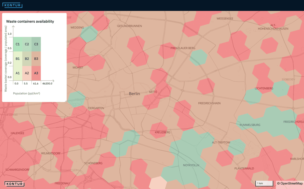
Smart Waste Management solutions
One of the first steps in ensuring an optimal waste collection process in cities is to assess the current availability of waste bins near all populated spots. Our new Waste Bin Availability layer lets you quickly identify areas lacking waste containers and baskets based on publicly available data. For commercial clients, we can augment these data with proprietary sources.
A complex decision, such as evaluating an optimal location for waste management infrastructure objects, requires estimating various factors and constraints. We also apply Multi-Criteria Decision Analysis (MCDA) so that you can select and combine multiple indicators with assigned weights to determine optimal locations for infrastructure assets. This approach can provide invaluable insights to city planners looking for ways of improving infrastructure and optimizing costs.