Atlas login
Efficient, Automated, and Customizable Solutions for Fire Departments
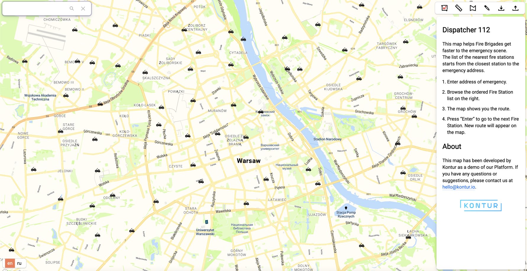
In times of fires and other emergencies, every second matters. That’s why fire departments need to respond quickly and work together to protect lives and minimize damage. At Kontur, we understand the challenges faced by fire dispatchers who need to make fast and informed decisions. It was the reason why we created Dispatcher 112, our fire dispatch software. It automates tasks, improves efficiency, and ultimately saves lives.
Fire dispatchers play a crucial role and need to be experienced and precise. They have to do many things, like confirming the incident location, finding the closest fire brigades, and evaluating the risk factors for each building. These tasks require focus and coordination, often under pressure, which can lead to human errors. Our fire station and fire dispatch software simplifies and automates these processes, reducing the mental load on dispatchers and improving their overall performance.
Key Benefits of Kontur’s Fire Dispatch Software
We used Kontur’s knowledge and technology to create a tool for emergency dispatchers.
Here are the key benefits of our Fire Dispatch App:
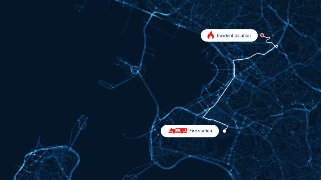
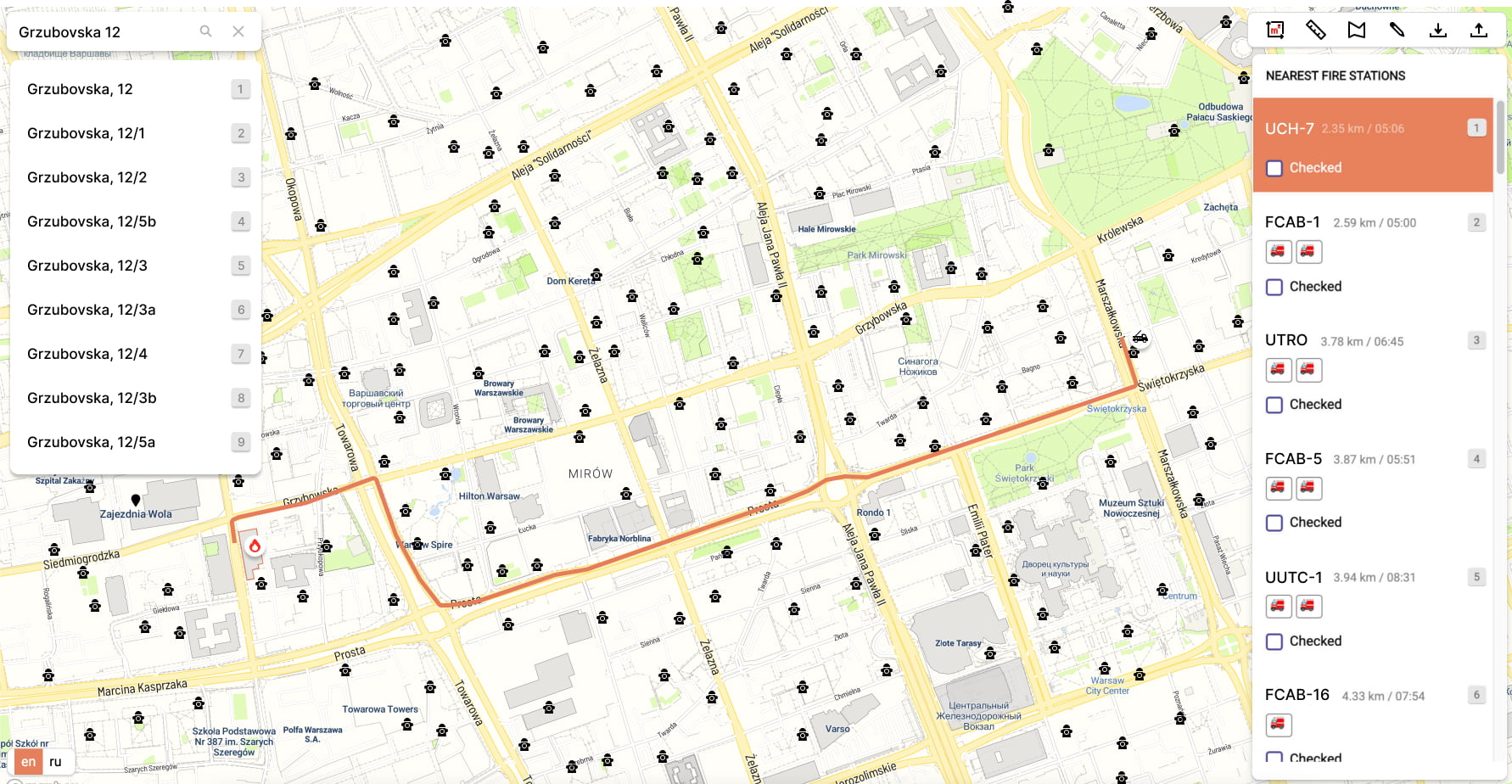
- Enhanced Incident Location Accuracy: Dispatchers can accurately identify the incident location, even if there are typos in the address or incomplete information. This reduces delays and allows firefighters to be dispatched quickly, improving response effectiveness.
- Optimized Routing and Resource Allocation: To ensure fire trucks follow special traffic rules, we use a custom algorithm to create optimized routes. This helps us allocate resources efficiently and achieve faster response times, resulting in quicker arrival at the scene and improved emergency management.
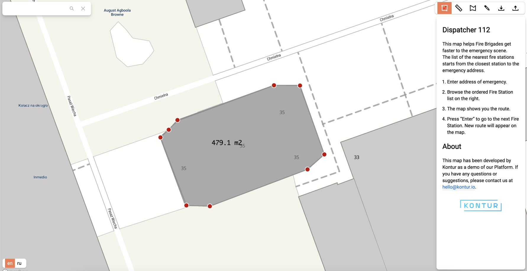
- Improved Situational Awareness: Dispatchers can see hydrants and fire stations on the map as well as use drawing tools to measure affected areas or find the distance to fire hydrants. This enhances situational awareness, enabling informed decisions and effective resource deployment.
- Comprehensive Fire Station Information: Detailed information about fire stations, including proximity to the incident and available equipment. Dispatchers can easily identify the nearest station with the required resources for a swift and targeted response.
Customization and Implementation
We know that each fire department is different and has its own specific needs and procedures. That’s why our Fire Department Software can be customized just for you. Whether you want to integrate it with your current systems, adjust it to match your protocols or add new features, our skilled team will create a personalized solution that fits your exact requirements.