Atlas login
Site selection analysis is a critical process that involves a comprehensive assessment of potential locations for a business operation, such as a new store, manufacturing plant, or office. It entails gathering and analyzing various factors, such as market socioeconomics, competition, transportation and infrastructure, labor availability, real estate costs, and regulatory environment. By conducting this analysis, businesses can make informed decisions about where to establish or expand their operations while considering the strengths and weaknesses of each potential area.

Commercial property analysis in a broad spectrum of fields
Quick Service Restaurants
Drop-off / Pick-up Points & Lockers
Distribution Centers
Retail stores
EV Charging Points
Shopping Malls & Centers
Apparel & Fashion
Franchise chains
Use cases:
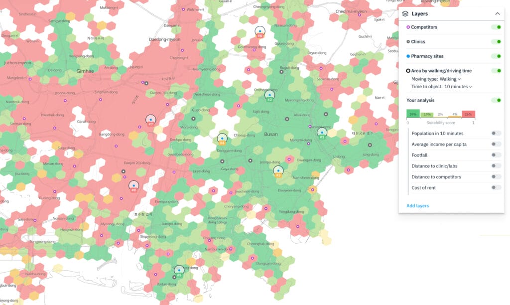
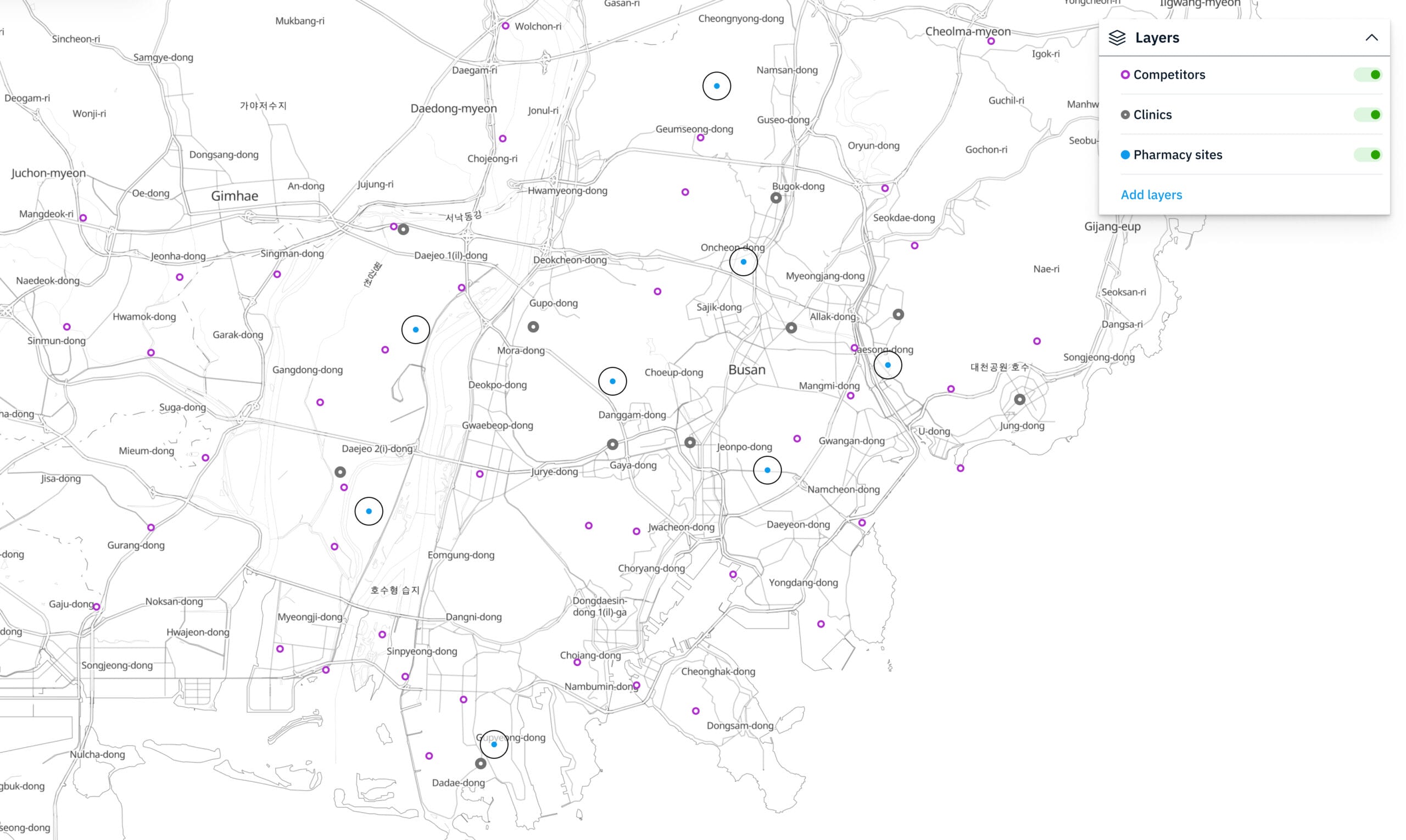
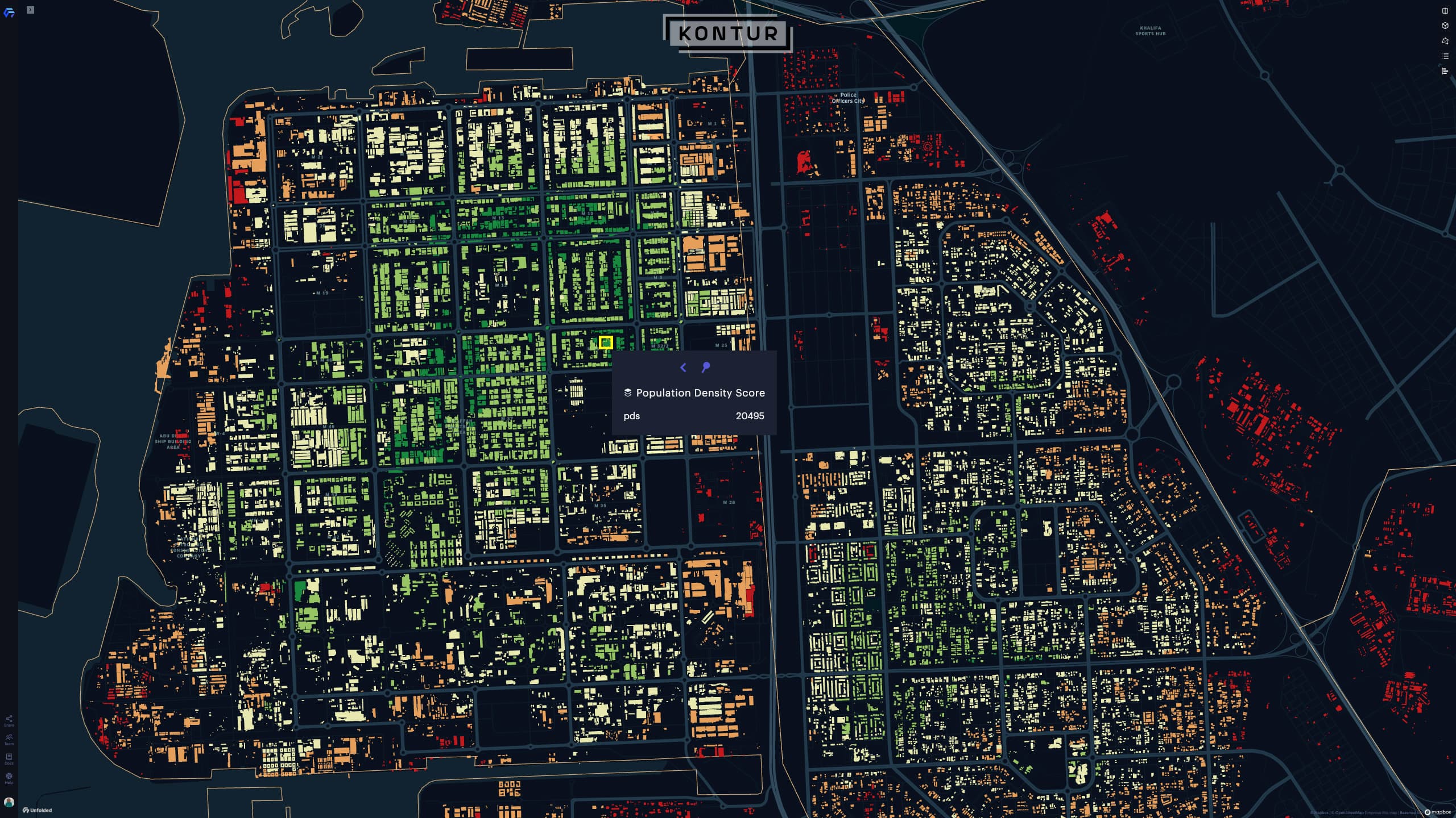
Retail site selection (Pharmacy location case)

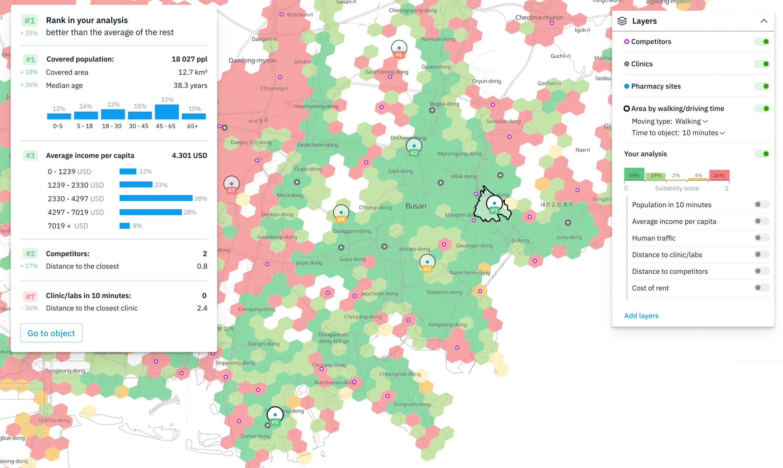
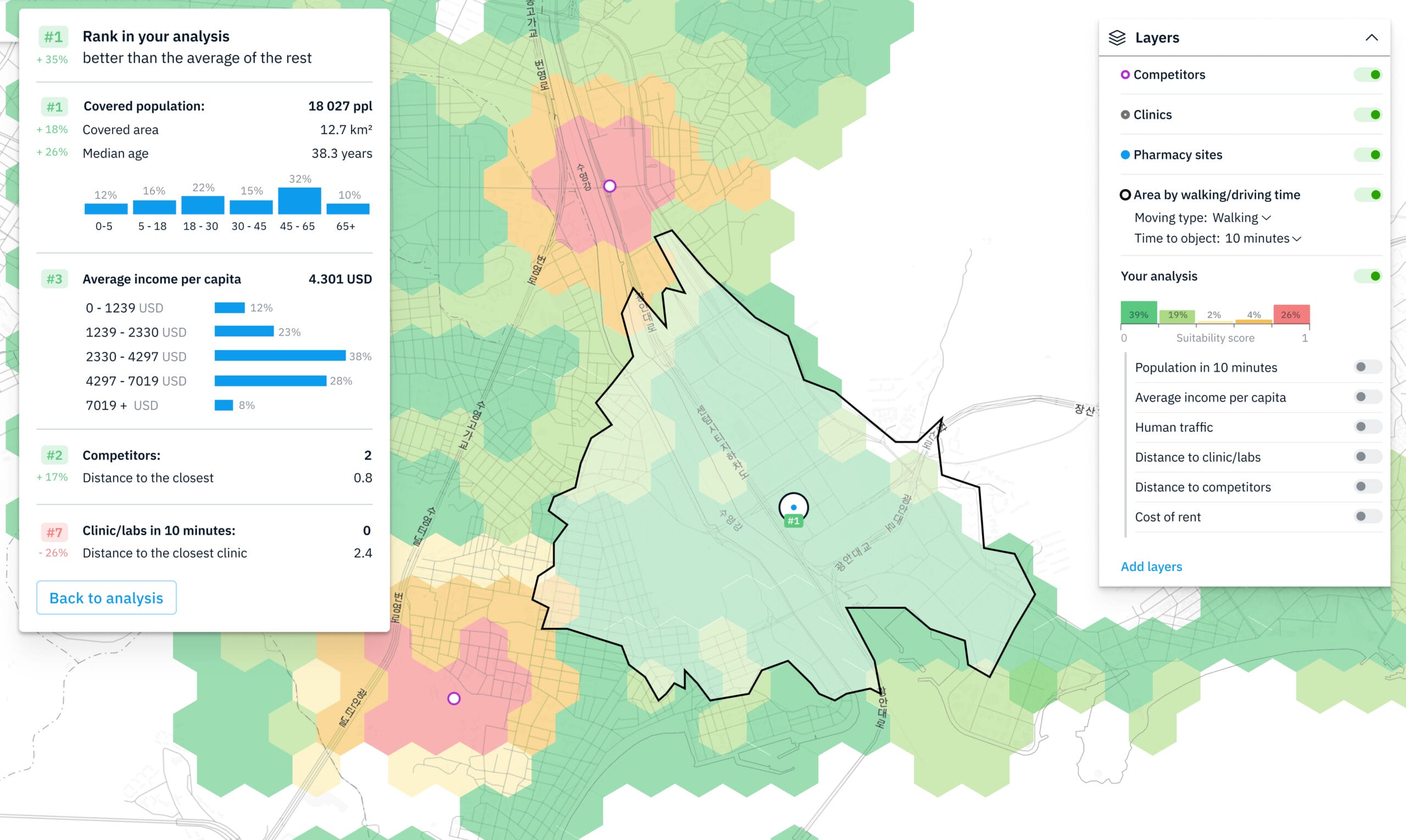
Site selection tools are valuable resources for identifying suitable locations for retail points, including pharmacies. In this case study, we analyzed a range of criteria, such as:
- Location footfall analysis
- Population of the catchment area within a 10-minute radius
- Average income per capita
- Infrastructure analysis (distance to clinics and labs)
- Competitors analysis (distance to competitors)
By considering these factors, we were able to determine the most favorable location for the pharmacy, which would maximize its potential for success.
Competitive analysis (Restaurants site selection case)
Choosing the right location for a restaurant is crucial for its success in a highly competitive industry. Site location analysis plays a significant role in maximizing footfall, capturing a target market, and leveraging existing customer overflow from nearby establishments. With the help of Kontur technology and geospatial data analysis, finding the ideal spot for a restaurant becomes a data-driven process, minimizing risks and optimizing logistics.
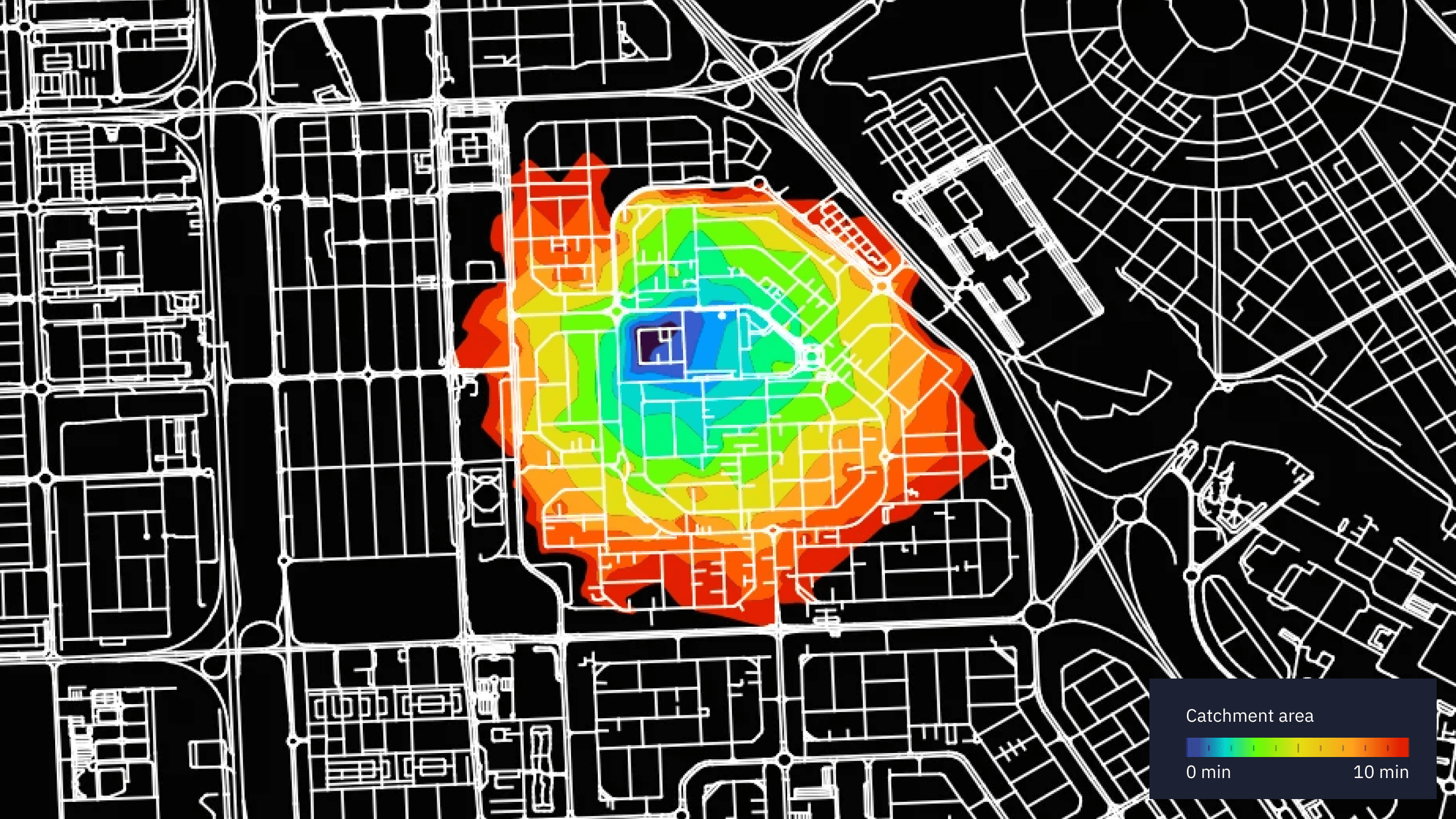
In this case, we analyzed the criteria:
- Population density
- Population of the catchment area within a 10-minute radius
- Competitors analysis
This research enables the rapid identification of areas with a high population density that are currently underserved by competitors. More about Case Study
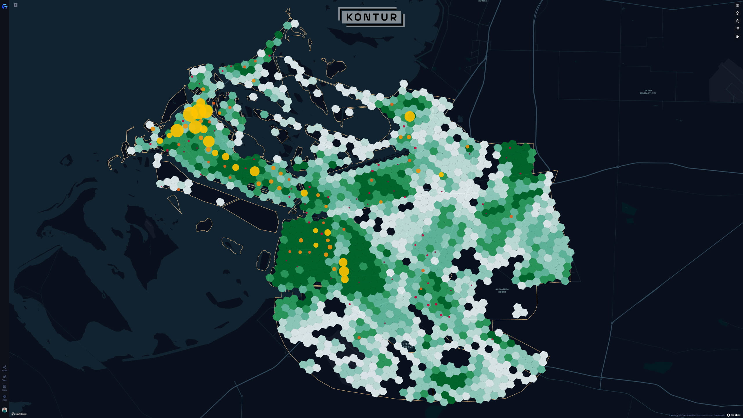
Industrial site selection (Solar farm site suitability)
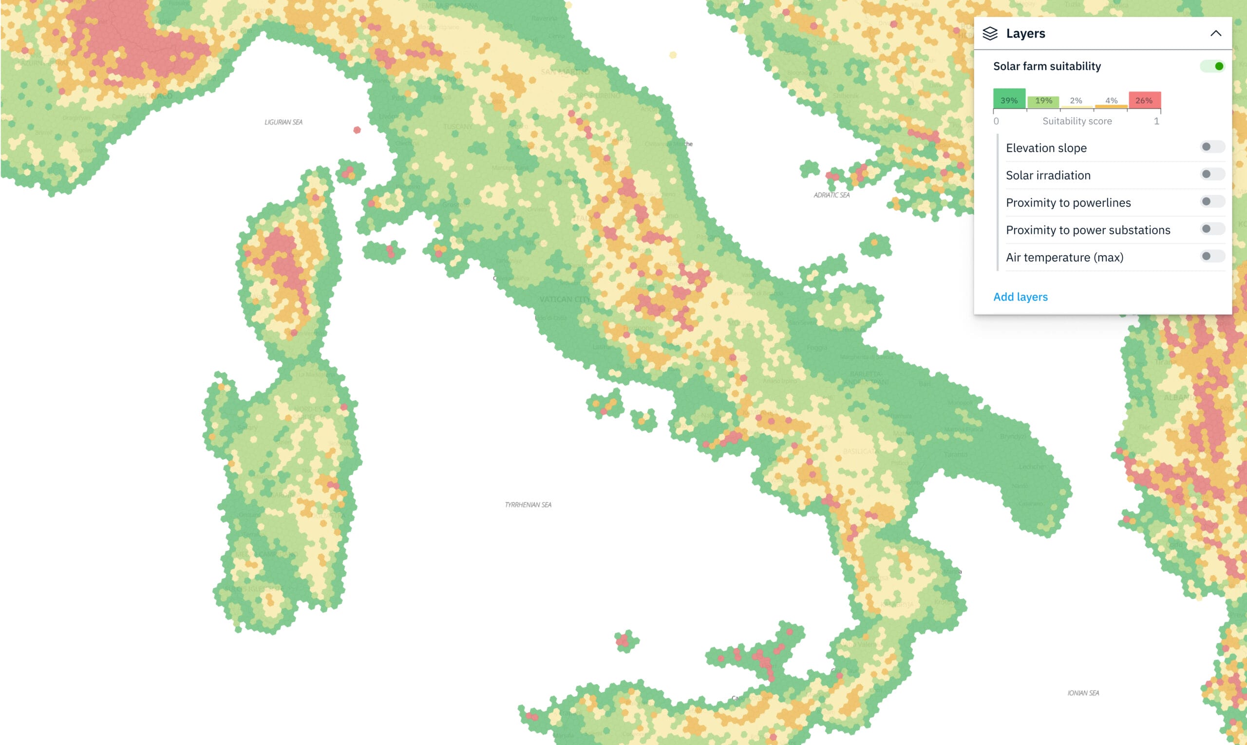
Industrial site selection tools are crucial for identifying suitable locations for solar farms. To optimize energy generation and minimize risks, we analyze various criteria, such as:
- Solar irradiation
- Elevation slope
- Proximity to power lines and substations
- Air temperature
By considering these factors, site selection tools can identify areas that offer the best potential for energy production, ensuring the development of sustainable energy sources.
What would you get?
When performing a site selection analysis with Kontur, you can expect to receive a comprehensive report that provides insights and recommendations on the optimal location for your business operations.
Our dataset catalog includes over 80 ready-to-use worldwide layers and can be supplemented upon request with any sort of input data, such as:
- Kontur population
- Global Horizontal Irradiance
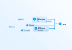
- Frequency of disasters
- Air temperature
- Nighttime lights intensity
- COVID-19 confirmed сases
- and more
A site selection analysis may also include a competitive investigation that analyzes the strengths and weaknesses of other businesses within the area, as well as any potential threats or opportunities.
A location selection analysis typically incorporates a detailed investigation of location-based data such as covered population, demographics, competition, labor accessibility, and infrastructure.
After researching, a report will suggest the most suitable places for your company’s work, considering your specific requirements and objectives.
Example: A medium-sized chain of fast-food restaurants was looking to optimize and expand their presence in the city. After analyzing a set of their current locations and the ones available for acquisition, Kontur provided a ranked list with what-if analysis that allowed the chain to open a new location in the non-covered part of the city, close one of two nearby locations that were essentially fighting for the same audience, and reject an offer to acquire a restaurant that had looked good in the offer papers but did not really add any customers to the chain.
This allowed the chain to grow its market share by 10% and build up its presence in the emerging market of food delivery without growing its operational expenses.
When conducting site selection analyses, potential threats to business operations, such as environmental risks in a specific location, are also taken into account.
In general, a site selection investigation can provide valuable insights and data-driven recommendations that can assist you in making informed decisions about where to establish or extend your business operations.