Atlas login

What is a catchment area?
A catchment area refers to the geographic boundary surrounding a business or organization where they can attract customers or users. It is often used by businesses, franchises, institutions, and service providers to identify their target audience and develop marketing and sales strategies.
Use cases
Here are several use cases, where the creation and visualization of catchment areas can be crucial:
Opening a new location
If you own a successful pizza chain with several stores in the city, and you’re planning to expand by opening a new location, you might be facing the challenge of choosing the best spot for your new restaurant. Your real estate agent has probably provided you with several potential locations, but you want to make sure you select the one that will bring you the most customers while also considering your delivery capacity.
To make sure you’re maximizing your potential customer base, it can be useful to look at additional analytics involving the population in the area.
It’s also a good idea to find overlapping zones for each potential location, as this will help you avoid selecting an area that’s too large and potentially cannibalizing your existing business.
Competitor analysis
Visualizing the locations of your competitors and their catchment areas can help you identify your strongest competitors and understand which businesses you’re competing with for the same customers. You may also identify areas where there is already high competition and decide to focus your efforts elsewhere.
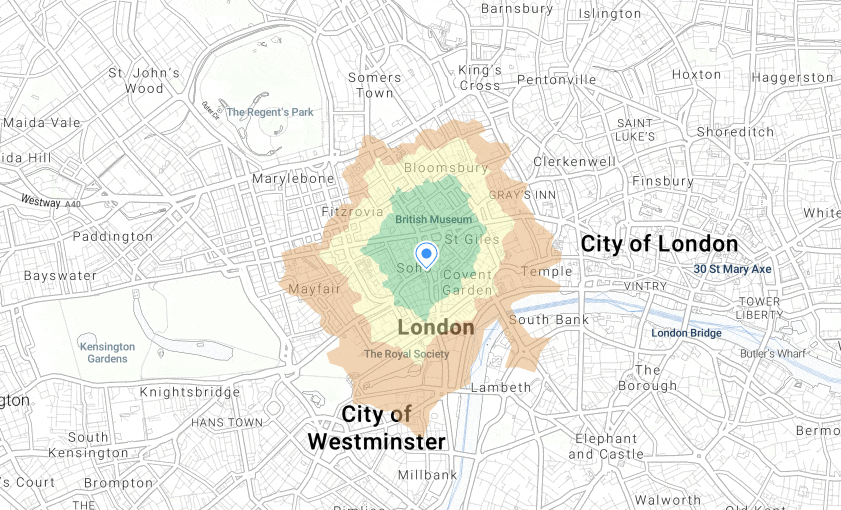
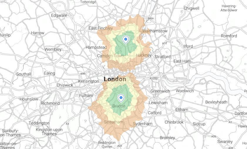
Let’s consider an example. If you own a pharmacy, you may want to assess the level of competition in your area and determine whether your location is optimal. To do this, you could create a radius map showing the other pharmacies that are within a 5-minute walking distance from your point.
You could also establish catchment areas for all of your competitors and focus on the overlapping zones to draw people from those areas to your location.
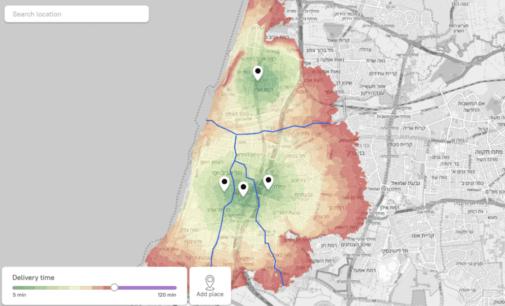
Delivery zones setting and optimization
As the owner of a restaurant chain, you may want to launch delivery services for several locations in the city, with delivery personnel walking to customers on foot. To optimize the delivery process, you need to split the city into zones based on catchment areas and define the areas in which you can deliver within 20 minutes or less.
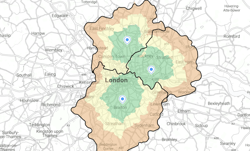
Finding gaps in coverage
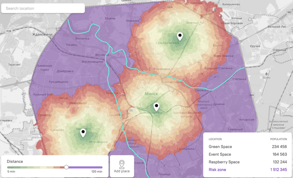
Let’s say you are a restaurant with a delivery service looking to expand your services into a new area. By mapping out the catchment zones of your existing places you can get a clear picture of the areas where your services are currently reaching and where there may be gaps in coverage. Additional value may bring information about the population in each of the missing zones so it would be easier to choose the right place for expansion.
Analytics that we can provide
Depending on the specific use case, analytics can provide additional value by enabling businesses to gain insights into their customers, competitors, and operating environment. Through calculations, it is possible to determine a range of factors, such as the number of people located in a specific zone, their age distribution, and even their income levels. This information can be used to develop more effective marketing strategies, identify new business opportunities, and improve overall operational efficiency.
In some cases, it may also be useful to calculate the number of buildings, hospitals, or other amenities located in a catchment zone. This can provide businesses with a better understanding of the local environment, including the level of competition, the potential demand for services, and overall market dynamics. By leveraging analytics to gain these types of insights, businesses can make more informed decisions and achieve greater success in their respective markets.
Types of catchment areas
It also can be valuable to know about types of catchment areas, as different can be used for different use cases.

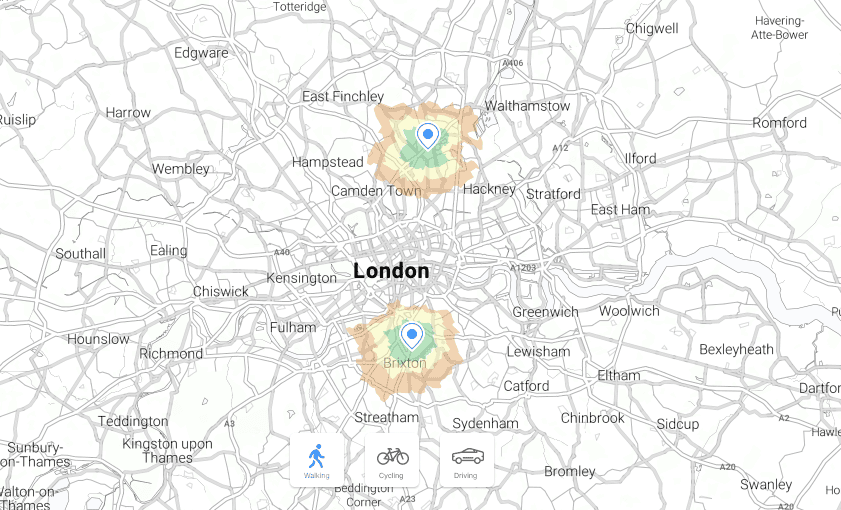
With the help of catchment areas and radius maps, you can easily visualize your use case and gain insights into your customer base. Kontur provides a solution that allows you to calculate catchment areas based on drive time, bicycle time, walking time, distance or just the crow flies. This means that you can tailor your catchment area to your business’s specific needs.