Atlas login


Services
Solutions
Kontur Atlas
Your gateway to geospatial intelligence, offering comprehensive data, algorithms, and tools for tackling challenges in mapping, location data, and spatial analysis. Transform decision-making with precision and ease.
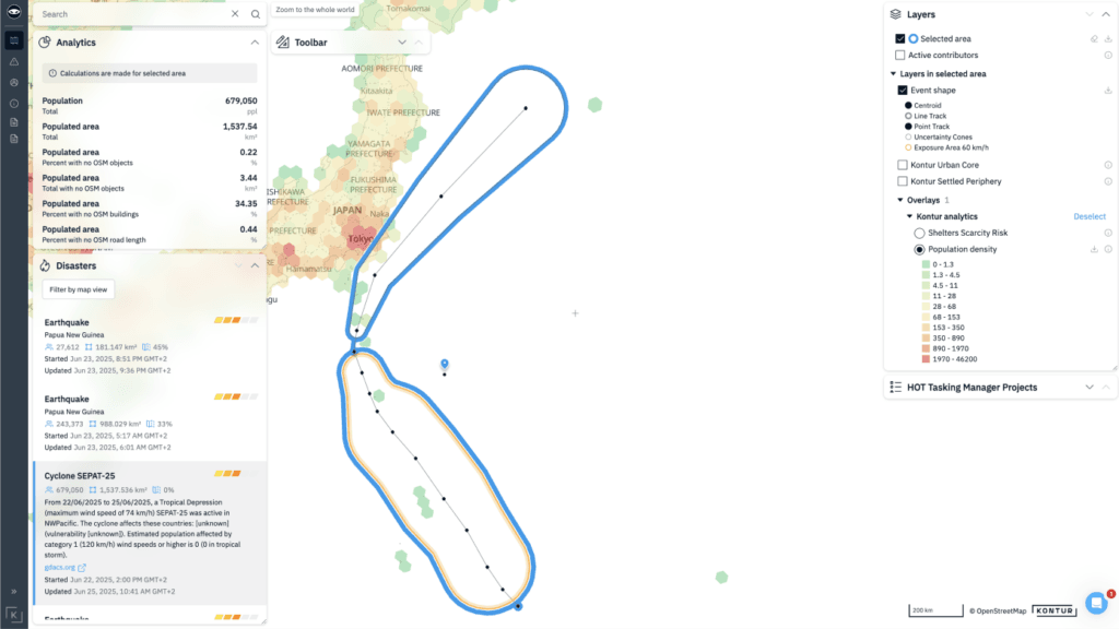
Disaster Management Solution s
s
We have created several user-friendly interfaces to help manage disaster response, assess current situations, gather insights, and make informed decisions across various fields.
Smart City Solutions
Kontur offers various tools to empower municipal authorities, urban planners, and businesses with geospatial analytics and situational intelligence for achieving smart city objectives.
Climate Change Solutions
Kontur is at the forefront of providing innovative solutions to tackle climate change. Our geospatial solutions are designed to address various aspects of this multifaceted challenge. We offer tools for preparedness, mitigation, emergency response, and climate change adaptation.
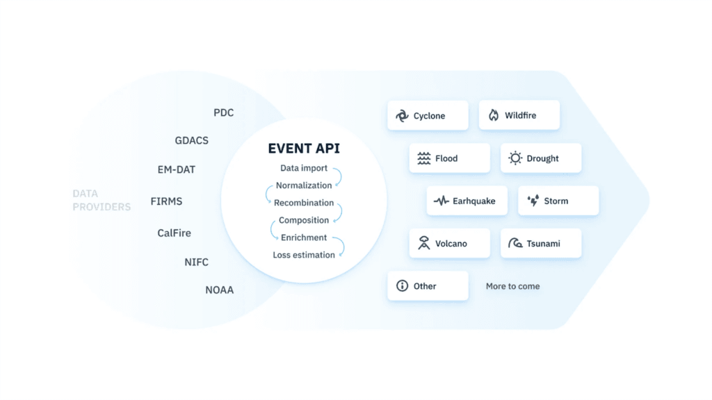
Geospatial data pipeline
Geocint is our unique open source ETL data pipeline framework, leveraging the power of PostgreSQL, PostGIS, and H3 hexagons to provide a high-throughput, standalone geospatial data ETL/CI/CD pipeline.