Atlas login
In case of fire unfolding outside your window, it is vital to know where to find breathable areas nearby. When a threat develops rapidly information should be available at your fingertips. Therefore Kontur has been able to gather information about fires and air quality conditions into a tool accessible for mobile devices in real-time.
Why Kontur created Global Fires
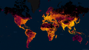
The area affected by wildfires increases from year to year. The number of people, animals, and infrastructural objects that suffer from fires follows this trend.
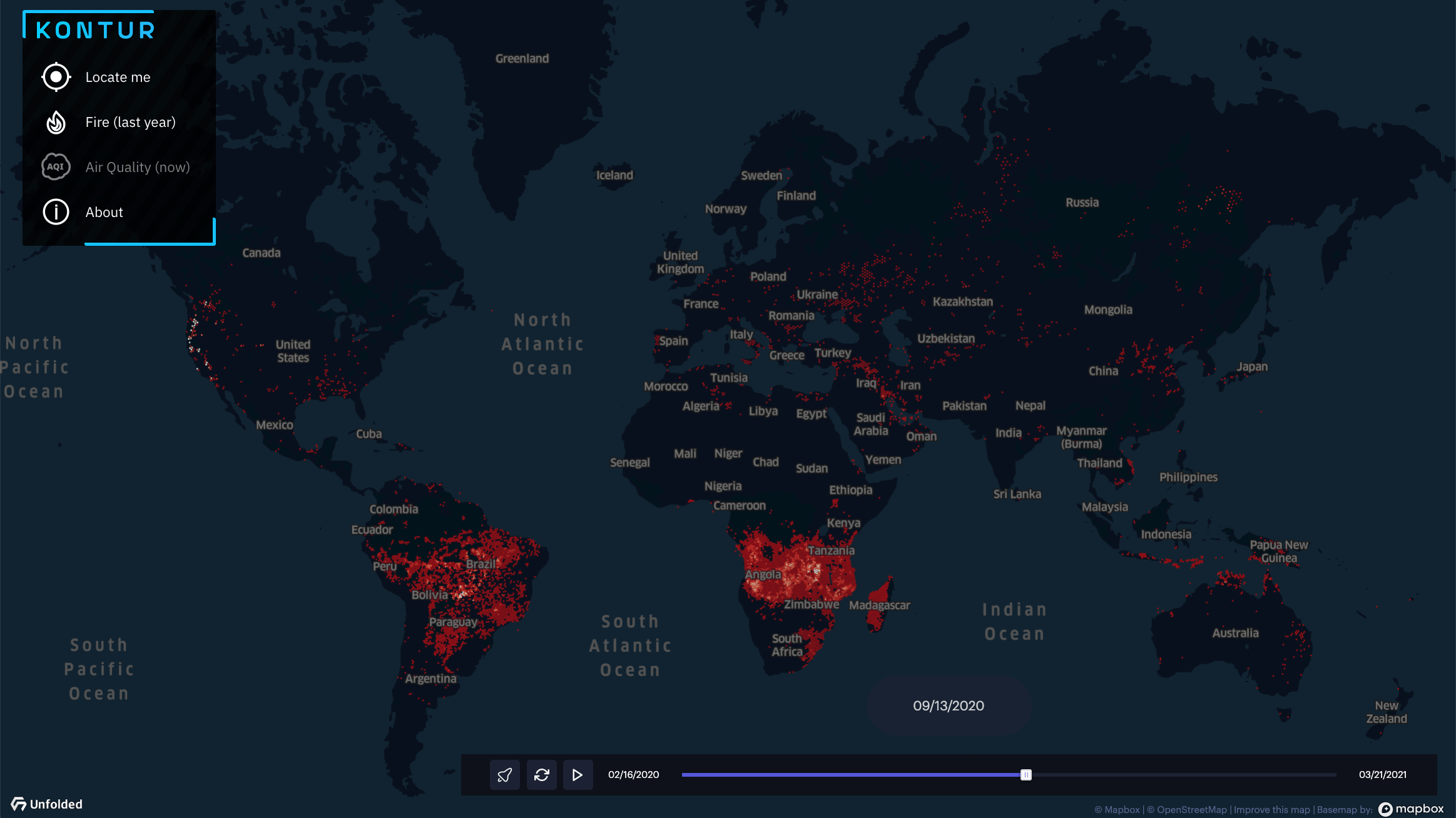
Widespread burning during warmer and drier seasons rapidly becomes the “new normal” across continents. The year-by-year analysis showcases that wildfires occur and evolve in a similar pattern. That makes it possible to predict how critical situations unfold and map out the action plans to fight the fires and avoid the consequences of this threat.
People are responsible for 75% of all wildfires in recent years. Vast territories in Africa from both sides of the equator get covered with fire every year due to slash-and-burn agriculture. Negligence and human-caused accidents are the leading cause of fires in the Northern Hemisphere.
Fires take a heavy economic toll. Areas affected by wildfires in the U.S. drop in property values by 10-20%. Australia has lost an estimated $2.9 billion in tourism as a consequence of the 2019-2020 fires.
Fire is not the only threat. It is always accompanied by air pollution. Wildfire smoke can stay in the atmosphere for weeks and even months. It puts huge populated areas at risk by traveling up to thousands of kilometers. Every year air pollution from wildfires is estimated to cause more than 300,000 premature deaths across the world.
Wildfire season often occurs during hot summer and fall weather. It may pose health risks to remain indoors with windows and doors closed in homes without air conditioning during this time. It means people should seek protection via other means including finding places not polluted by wildfire smoke. To do so there should be a friendly and accessible tool to track the air quality and fire state in places nearby to take action.
What we built
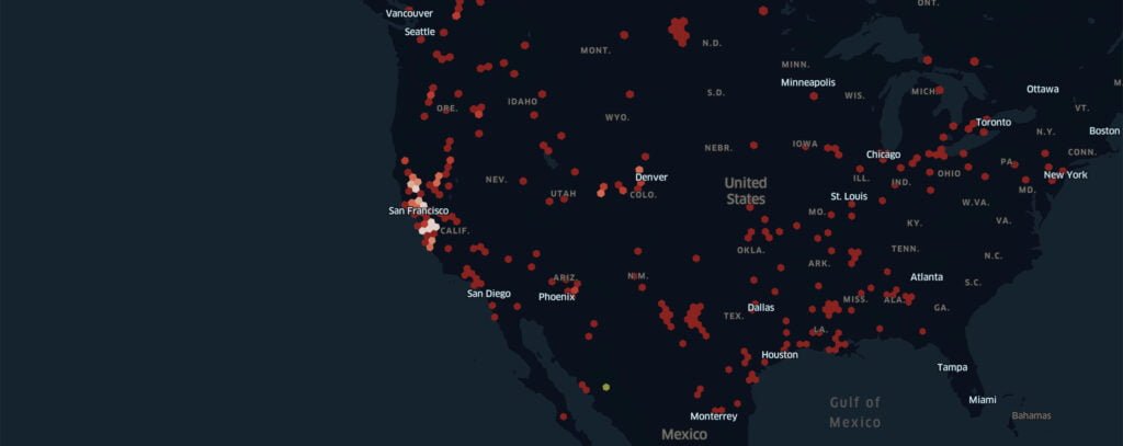
Kontur’s Global Fires viewer lets you see a year of fires on your phone and find places nearby with clean air to escape during wildfire season.
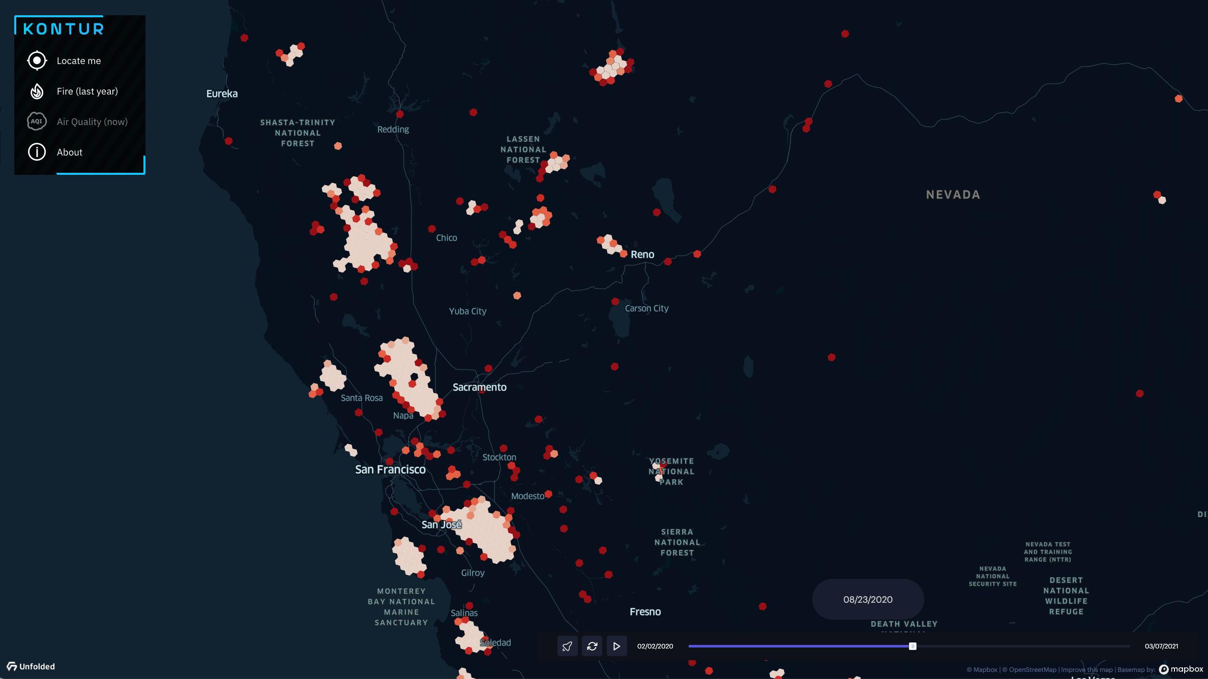
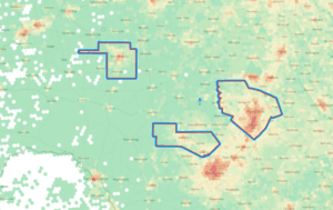
We customized the Unfolded Map SDK to make a tool to browse the data of fires for the past year and monitor the air quality state for the past three days on a mobile device. Kontur Event Feed is used to provide the event data.
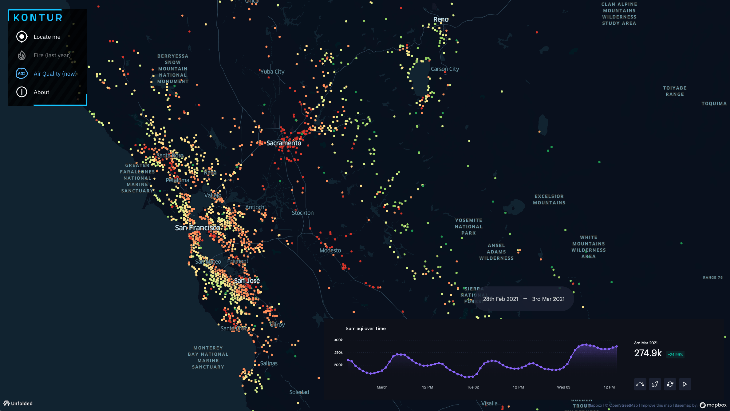
Air quality is displayed using several categories from good (green) to hazardous (red) measuring the levels of PM2.5 particles in the atmosphere.
Contact us to get Kontur Event Feed with 20 years of fire data.
If you have questions about Global Fires or need a similar solution, get in touch through our chatbox in the bottom right corner of this page.