Atlas login

What we can help with
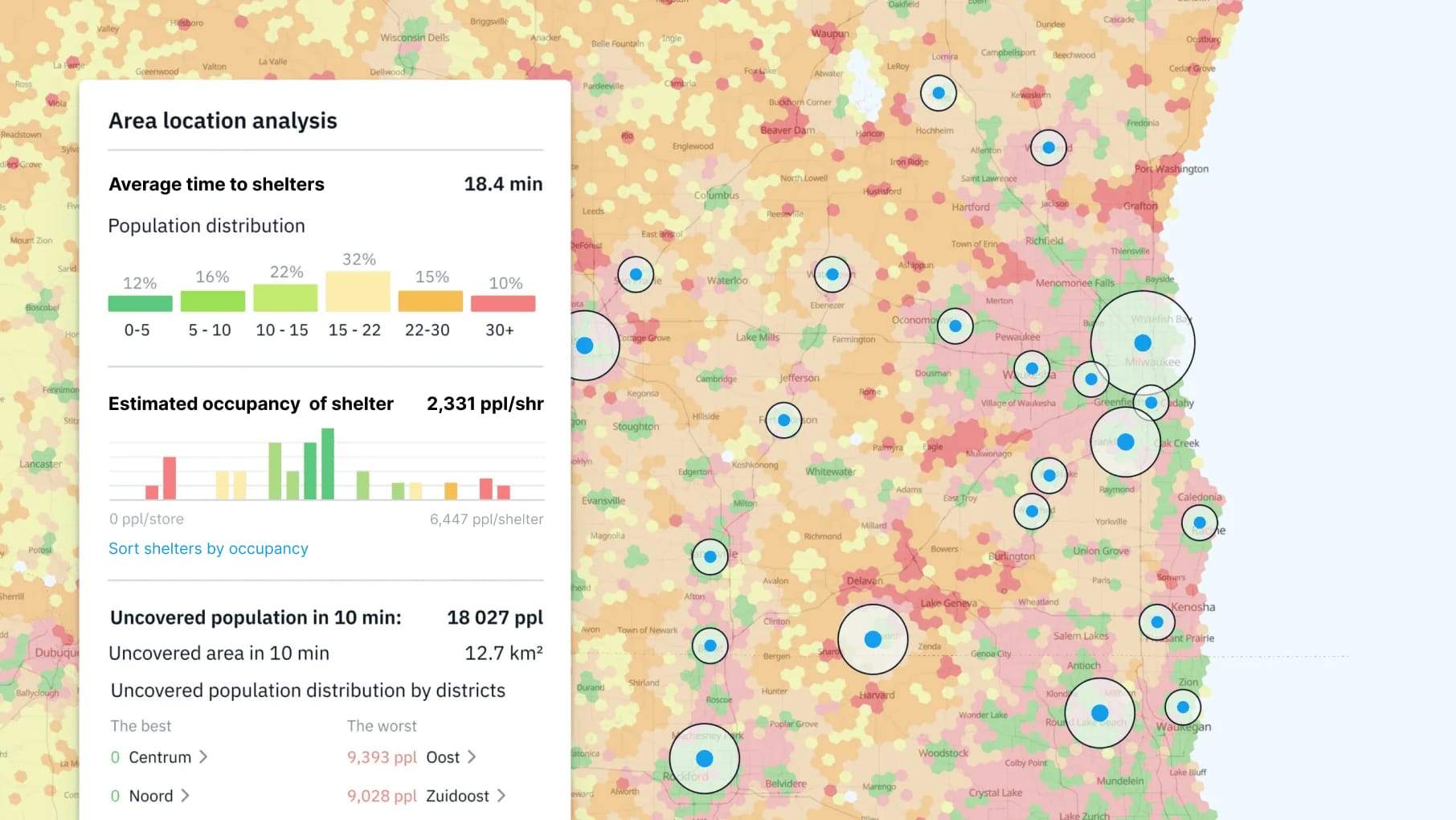
Get geospatial analytics and disaster risks
This is an example of …
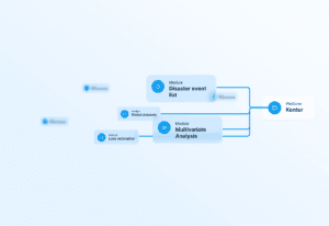
We can analyze almost anything you need.
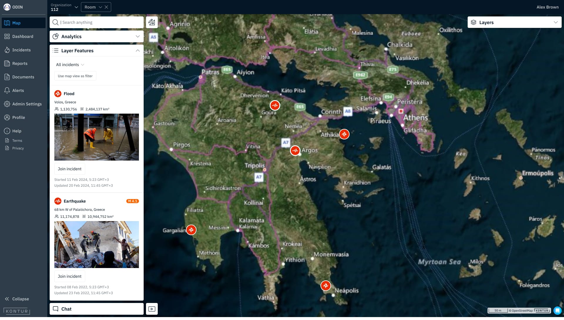
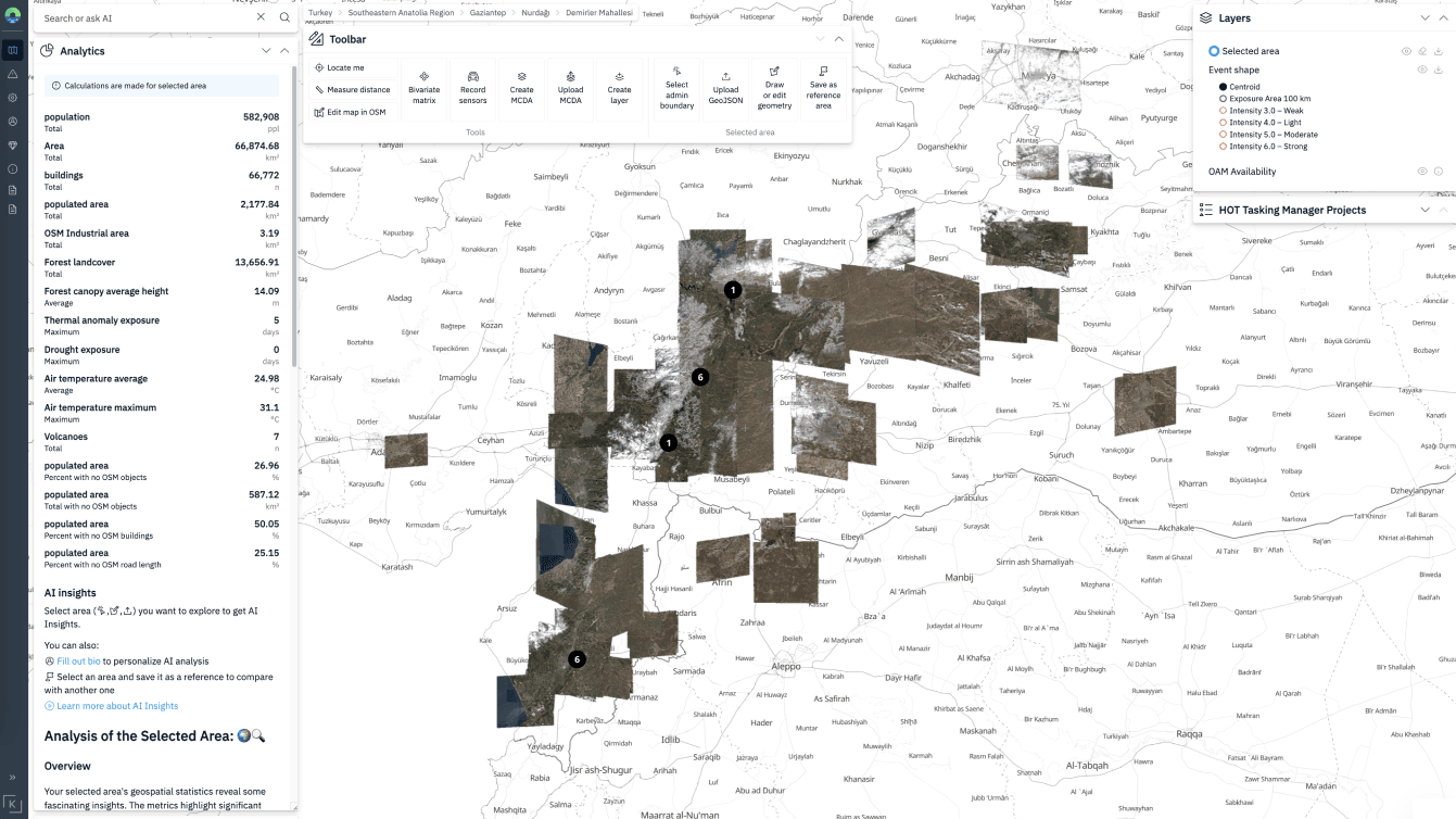
Monitor the situation in real time on the map
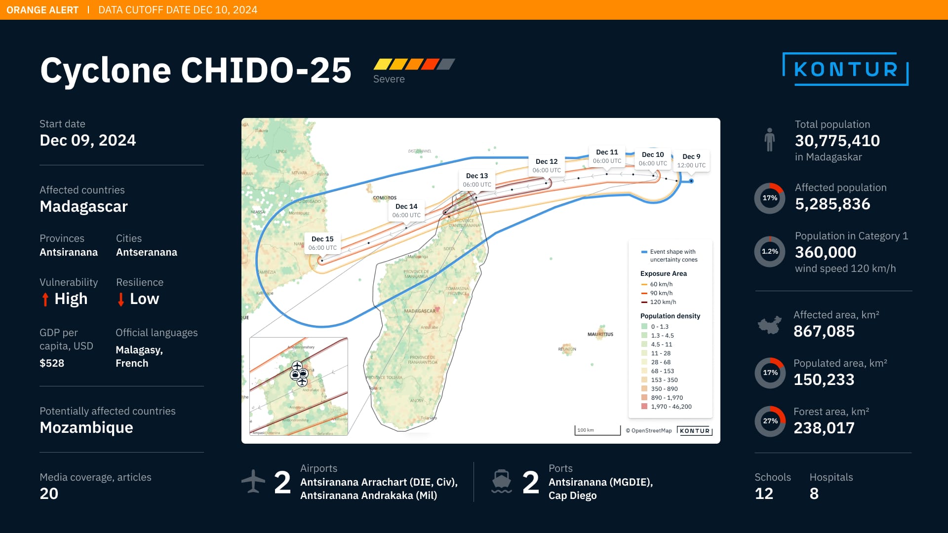
This is an example of hurricane Jan real time tracking.
We can display your private data or publicly available data in real time.
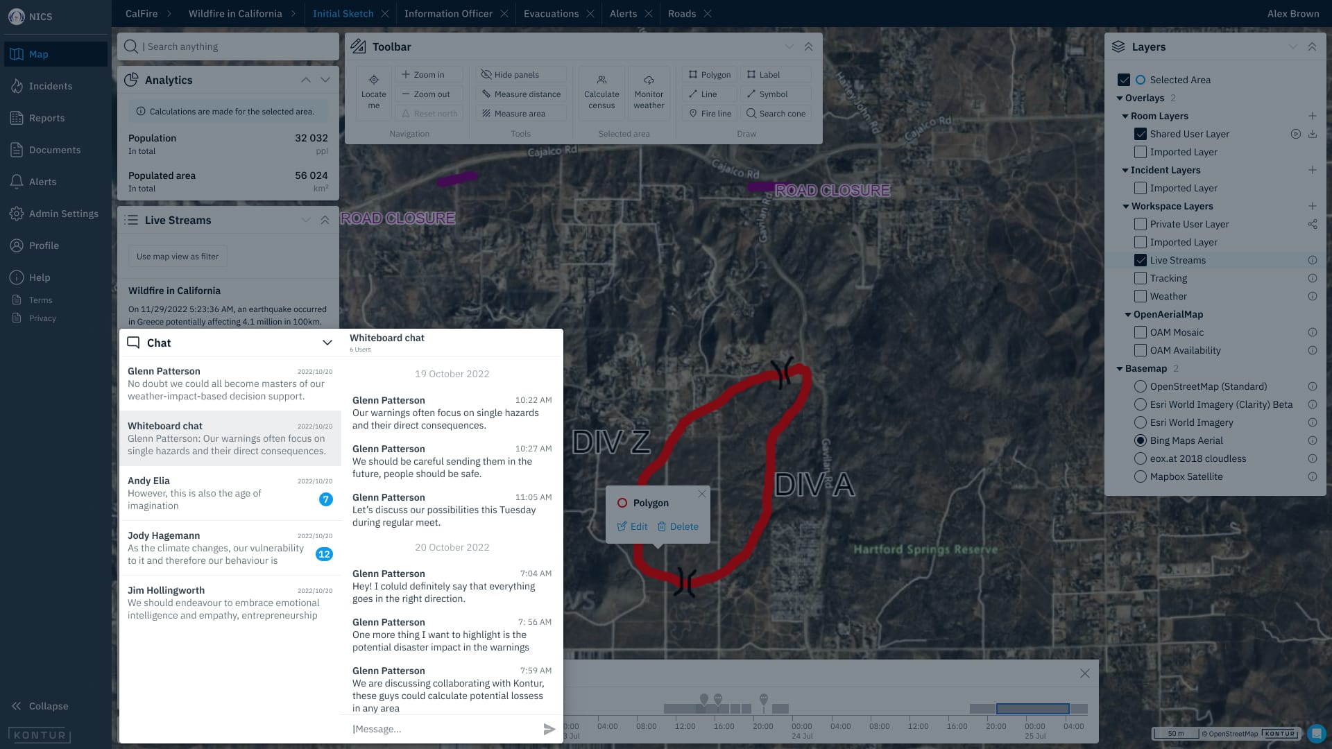
Coordinate actions
This is an example of maps and chats in one tool.
Track disaster events on the map in real time
This is an example of … .
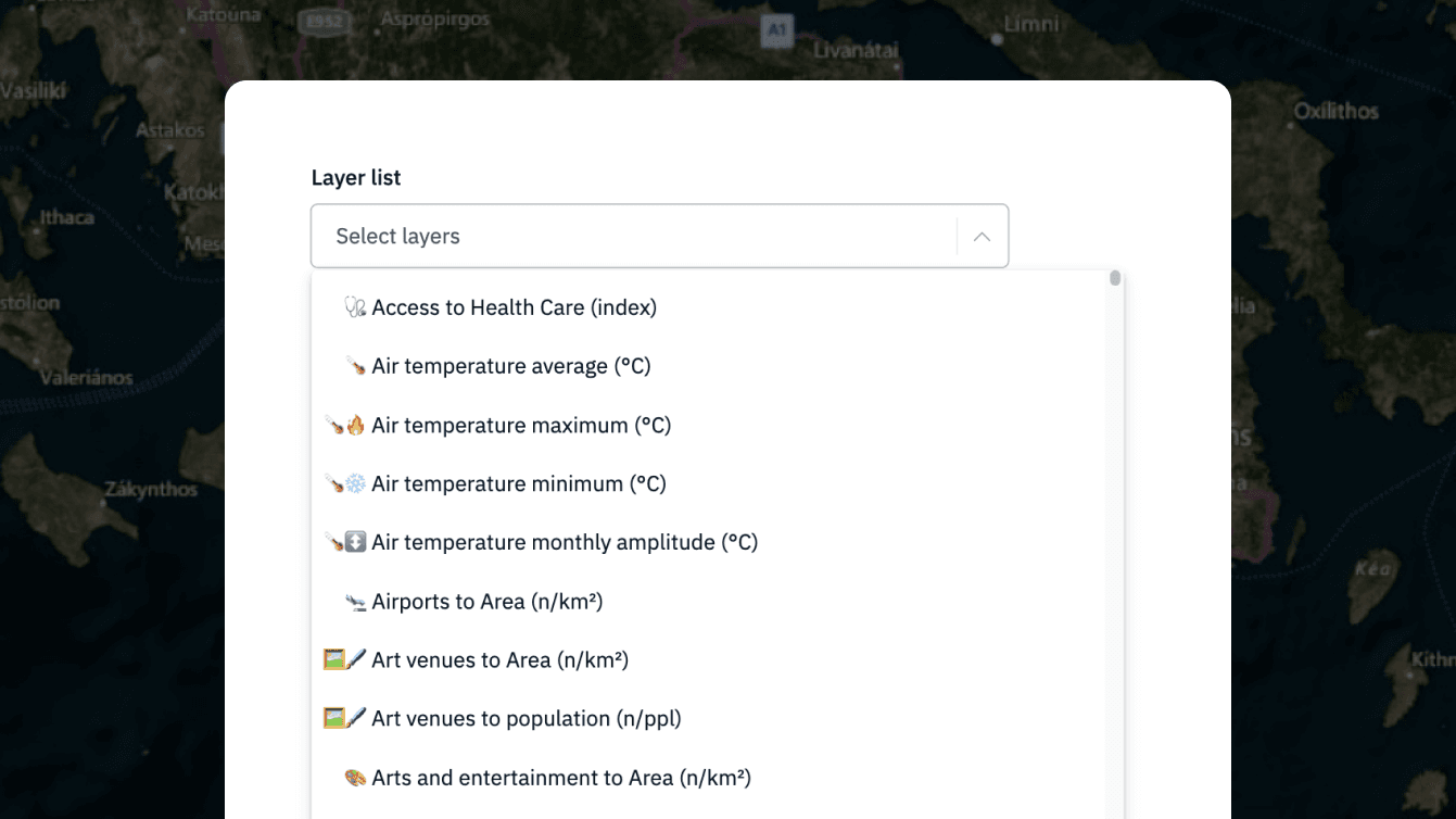
Get worldwide or regional geo data
200+ worldwide ready-to-use hexagonal layers in Kontur dataset collection
Overcome the limitations of your geospatial tools by using our flexible customization tools
This is an example of …
Key product features
Powerful tools for data visualization and analysis using H3 hexagons
Analytical layers
(Multi-Criteria Decision Analysis, disaster feed, etc.)
Statistic data of administrative units and reports
Geometry and trajectory of events on global coverage
Real-time notifications
User-friendly design for all levels of technical knowledge
Customization: solutions that work for your needs and regions
Delivering Our Best: Case Examples
Expertise in GIS for disaster management with extensive collaboration across humanitarian, governmental, and business sectors.

Our actions
Kontur automated MapAction’s GIS data collection and validation processes, streamlining the creation of disaster response maps.
Results that matter
This increased operational speed, saved volunteer time, and improved overall efficiency during emergencies.
Our actions
Kontur enhanced the OpenAerialMap platform with a user-centric redesign and new features, including an Orthophoto Map mosaic layer and streamlined & fixed image uploads.
Results that matter
These improvements made the platform more intuitive and efficient, enabling faster map creation for lifesaving missions.
Our actions
Kontur redesigned the decade-old QGIS website, improving its structure, navigation, and scalability.
Results that matter
By simplifying the donation process and aligning the design with community feedback, we enhanced usability and ensured long-term sustainability for the platform.

Our actions
Kontur developed Event Brief to automate disaster reporting, using data from PDC and its partners.
Results that matter
This innovation ensures rapid, accurate information delivery, empowering swift and effective decision-making during critical situations.

Our actions
Kontur created a custom geo-solution for GlobalGiving, enabling real-time disaster scoring and notifications.
Results that matter
The platform streamlines disaster assessment and delivers precise insights on its impact, helping the organization connect donors with critical grassroots projects faster and more effectively.
Other partners:


Special case
All disaster management organisations
The Kontur Population dataset provides detailed global population density information mapped to 400m H3 hexagons, making it an invaluable resource for humanitarian organizations worldwide.
Results that matter
With over 5,300 downloads on HDX, it stands out as one of the most sought-after datasets for planning and decision-making in critical humanitarian operations.