Atlas login
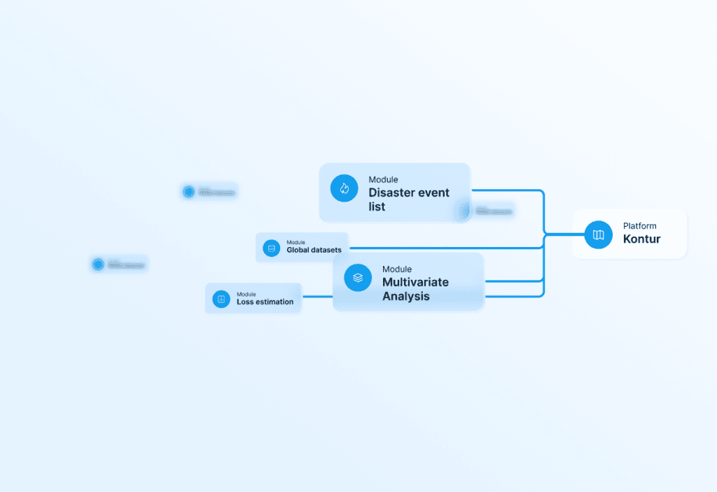
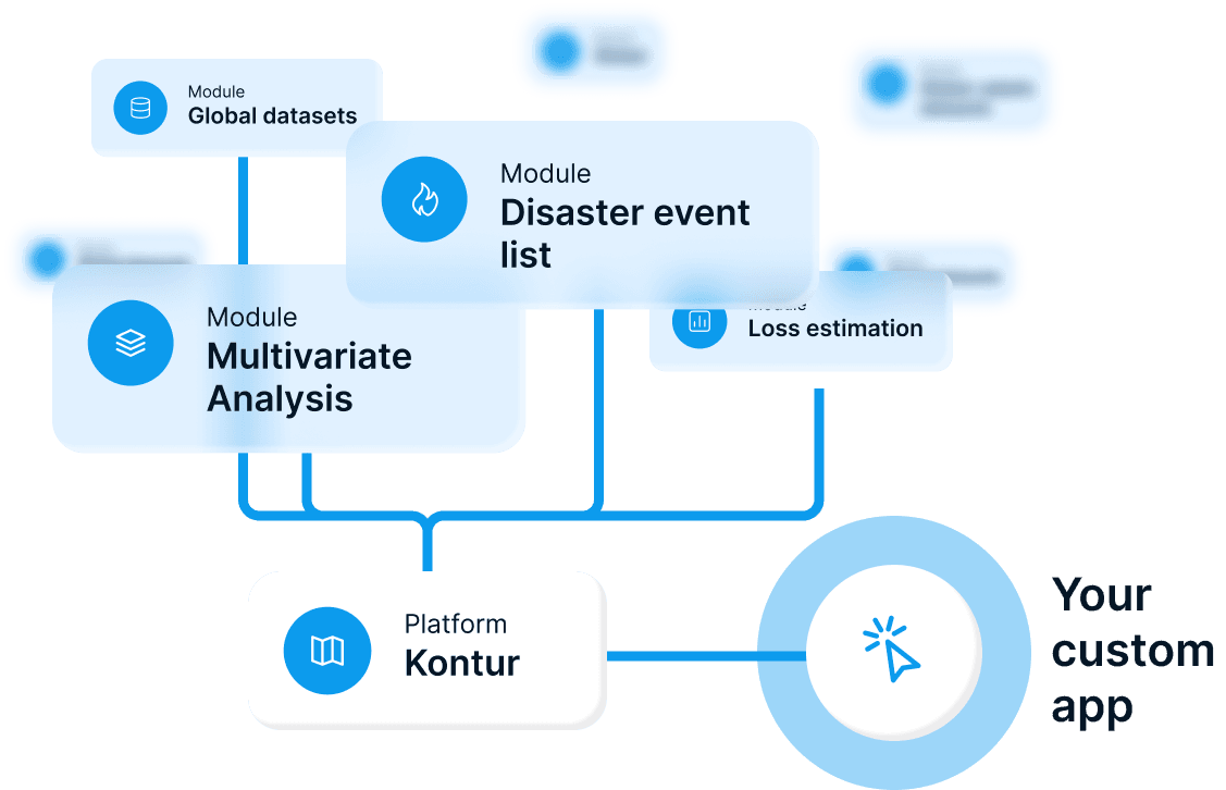
All-in-one spatial analytics platform
Helps insurance companies make Cat-Risk analysis, monitor real-time disasters, estimate losses, and process historical data and trends.
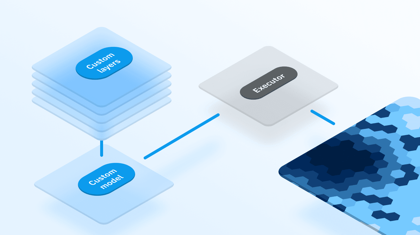
All modules are customizable, connected via API or web interface.
from $10 000/month depending on configuration
Trusted by industry leaders

Meet our ready-to-use modules
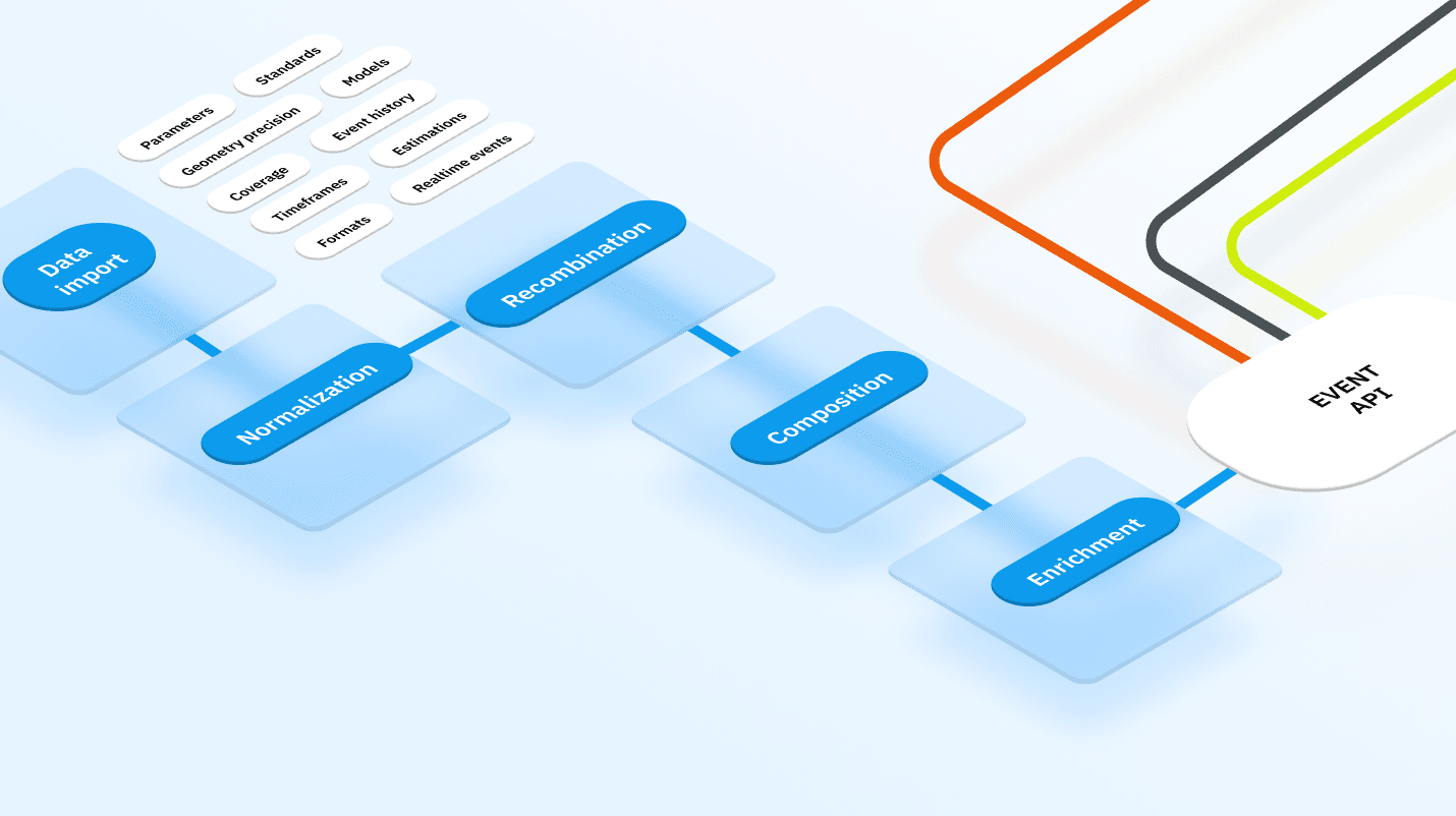
Disaster event feed
Online and historical disaster data built to price, underwrite & respond faster.
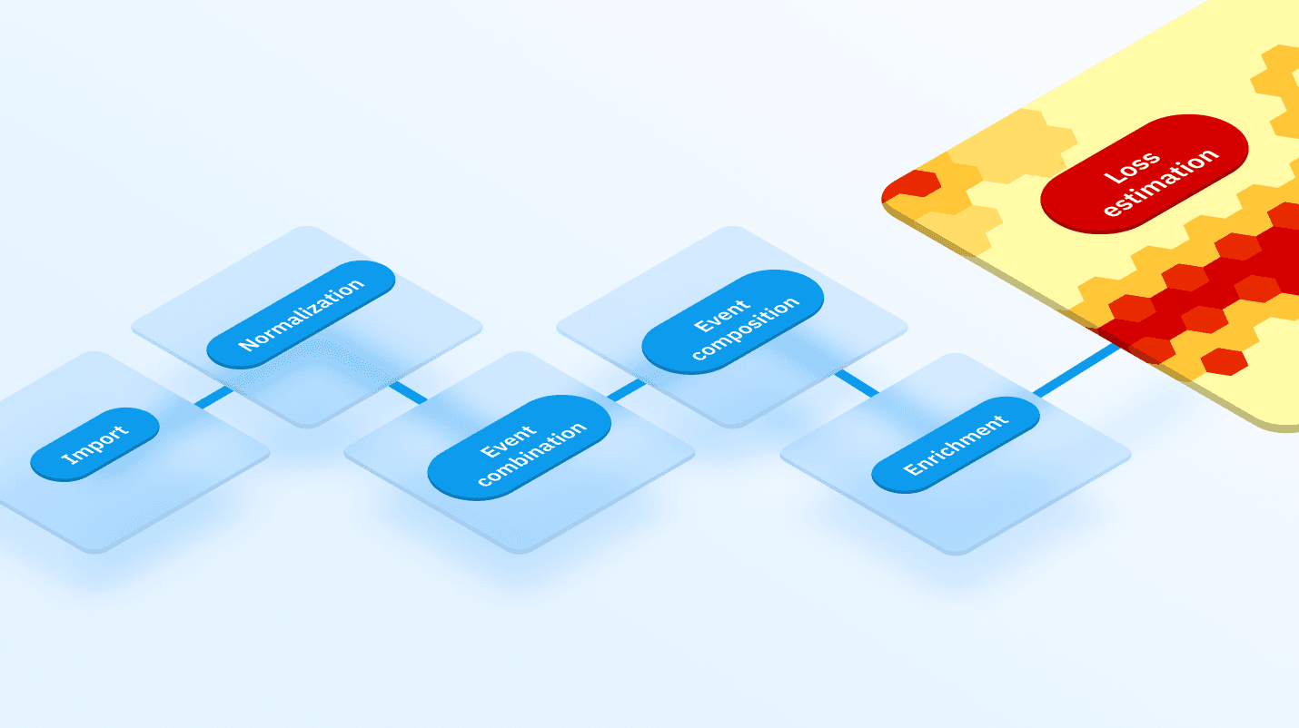
Loss estimation
Rapid loss analytics for immediate response.
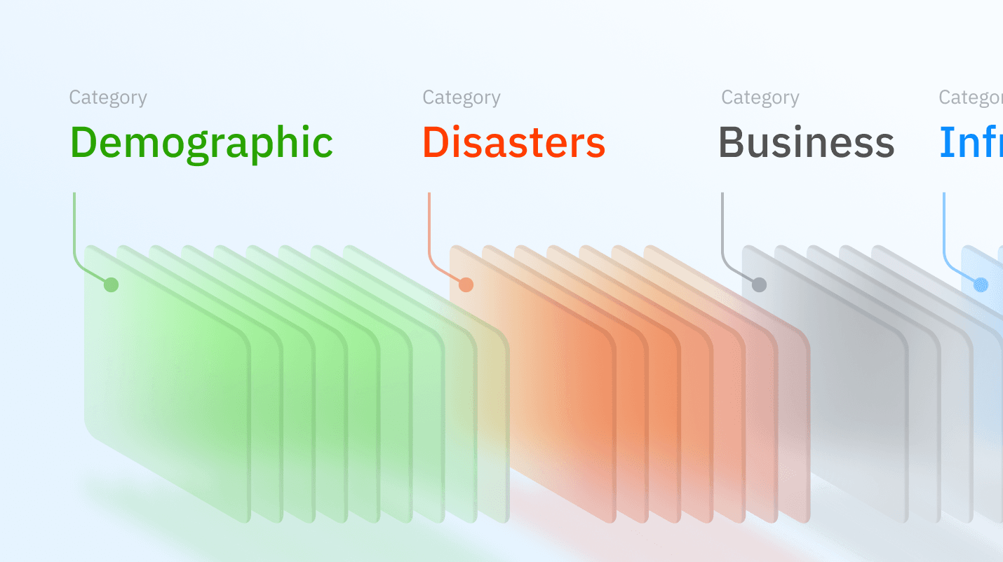
Global data analytics layers
The majority of the datasets cover the whole world, are normalized and are comparable across all regions.
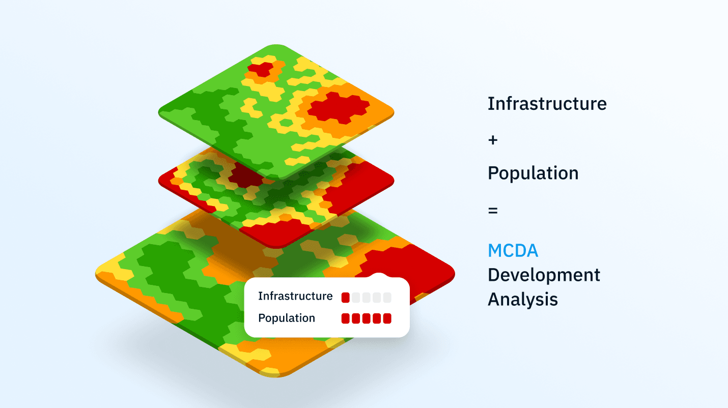
Multi-Criteria Decision Analysis for combining data layers and risk
Combine spatial data to gain valuable insights.
Flood modeling
Floods prediction and damage risk assessment.
Geocint
Allows to combine data from different sources and to update data promptly. Read more
CARBON360
Allows you to monitor the health of the forest.
AI Analytic panel
Translates raw data into a human-readable report.
Why choose us
Find out how we can adapt our developments to your needs.
from $10 000/month
depending on configuration
Global coverage
From the US and Europe to Latin America and Africa
Modular architecture
Connect the only functions you need
Customizable analytics
Forecasts and reports based on AI and flood models
Real-time data
Deal with disasters here and now