Atlas login
India Population Density Map
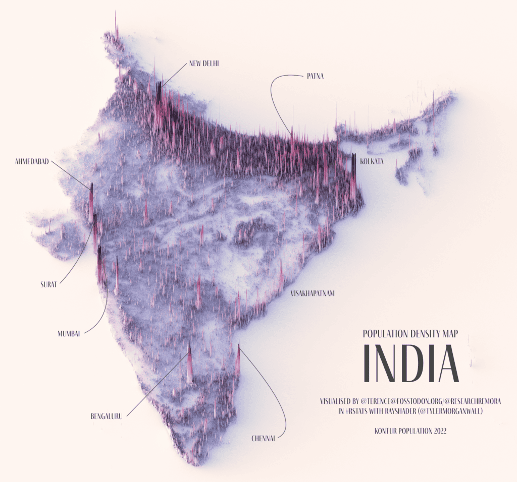
The Population Density map of India shows the distribution of the population based on Kontur Population Dataset. The map contains hexagons of approximately 1,300 feet (400 meters) in size.
The same map can be created by you for any country or state, using this tutorial.
You can also explore the interactive population density map of India here:
As of the 2011 census, the total population of India is 1,210,854,977. But at last count, more than 1.4 billion people live in India. This fact makes it a strong competitor to China for the position of the most populous country in the world.
Kontur Population is available under Creative Commons Attribution International (CC BY) license. You can use it for any purpose, even commercially.
The latest population data for India, provided by Kontur, is available on the United Nations Humanitarian Data Exchange (HDX). It provides information about the population density in India using 400m H3 Hexagons. The file size is 113 MB.
Kontur population dataset
Kontur Population is a publicly available dataset that provides information about population density across the globe. The dataset utilizes a grid system based on H3 hexagons, with population counts at a resolution of 400 meters. The dataset has various applications, including humanitarian mapping, waste management optimization, commercial site selection, emergency service coverage, and more.