Atlas login
by Andrey Sekste, Misha Malikin and Darafei Praliaskouski
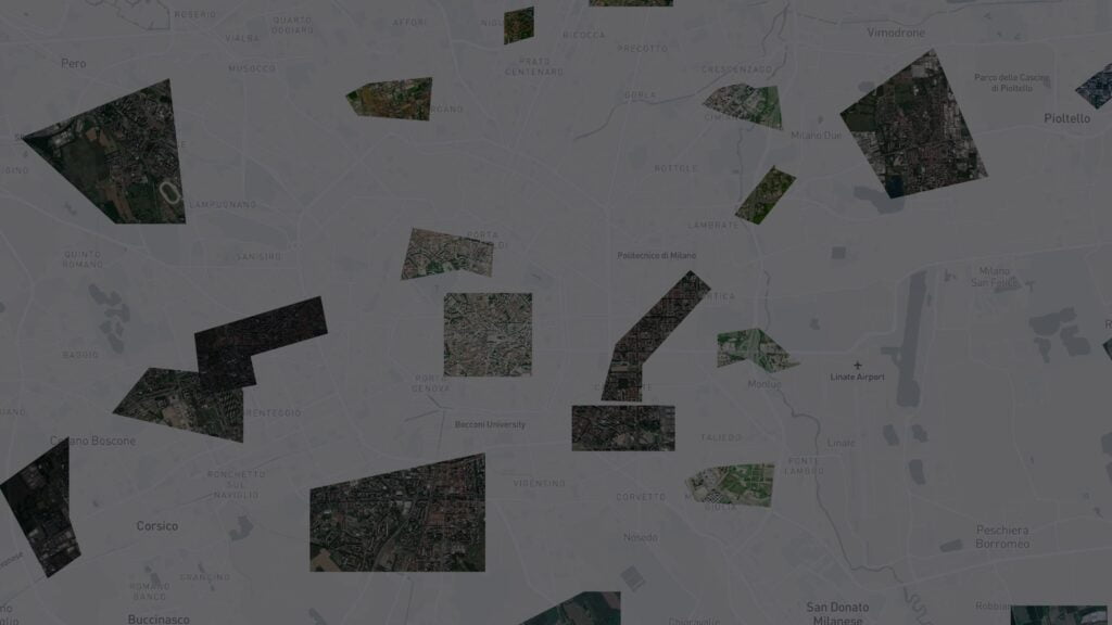
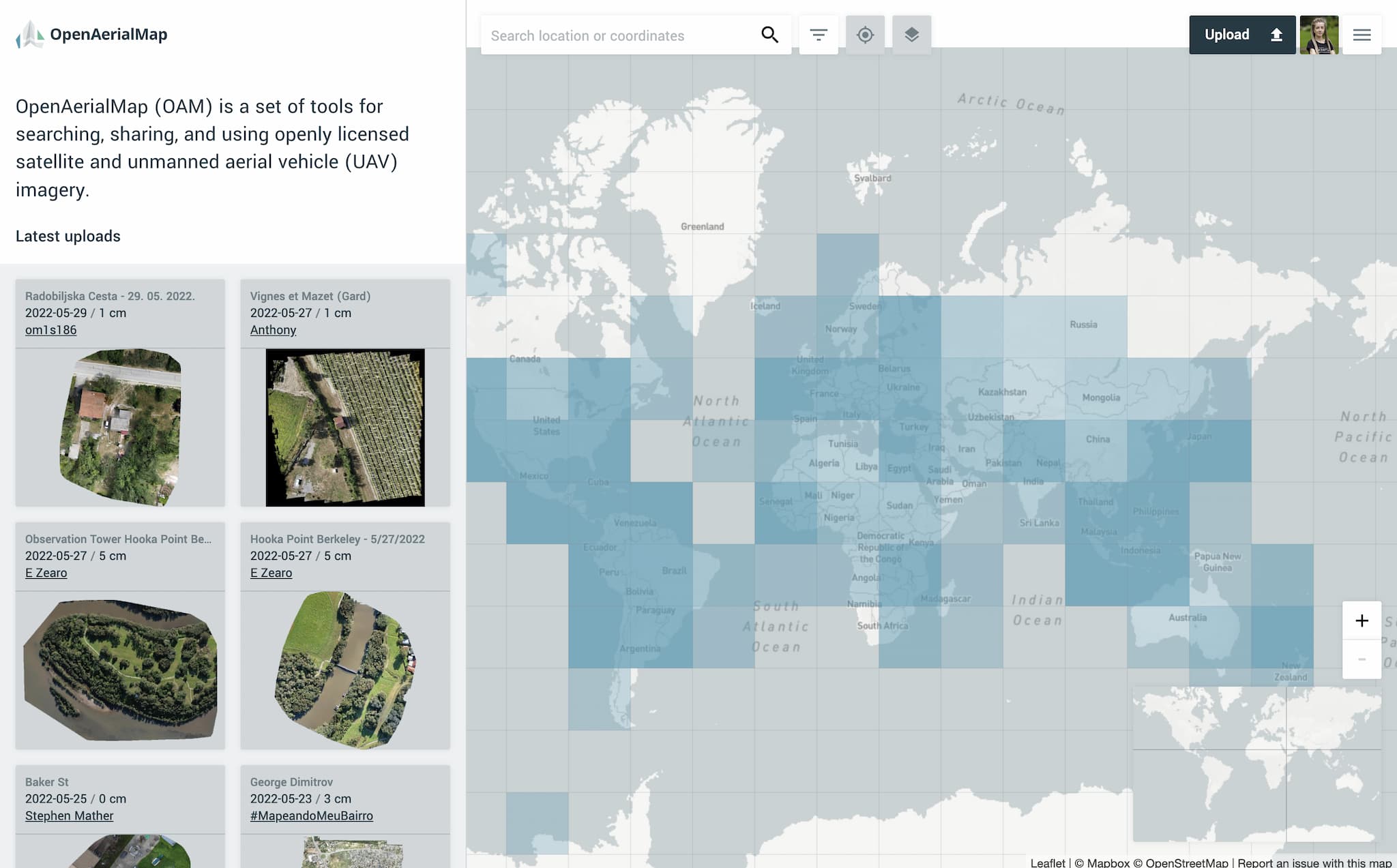
Since its inception in 2015, OpenAerialMap has been aiming to democratize Earth observation by providing tools for uploading, sharing, and accessing openly licensed aerial and satellite imagery worldwide. Freely available imagery is especially critical for humanitarian organizations working on disaster preparedness and response mapping projects, such as our long-time partner Humanitarian OpenStreetMap Team (HOT).
As an OpenAerialMap contributor, HOT also uses it as one of its tools in planning mapping campaigns. With the help of OpenAerialMap, it is possible not only to access existing images in a crisis-affected area but also to quickly upload and share new imagery taken by drone pilots during a disaster.
Together with HOT, Kontur shares a vision that quality maps should be available for everyone to use for the good of local communities. We have recently joined forces to take a fresh look at the open-source OpenAerialMap platform and collaborate on its potential redesign. Our goal was a modern and accessible platform built on human-centered design principles.
At Kontur, we believe in the power of customer centricity, agile methods, prototyping, rapid feedback, learning, and collaboration – all the elements of a product approach to software development and delivery. The product approach and the corresponding mindset fit both for designing new products and refreshing or updating existing ones with new features.
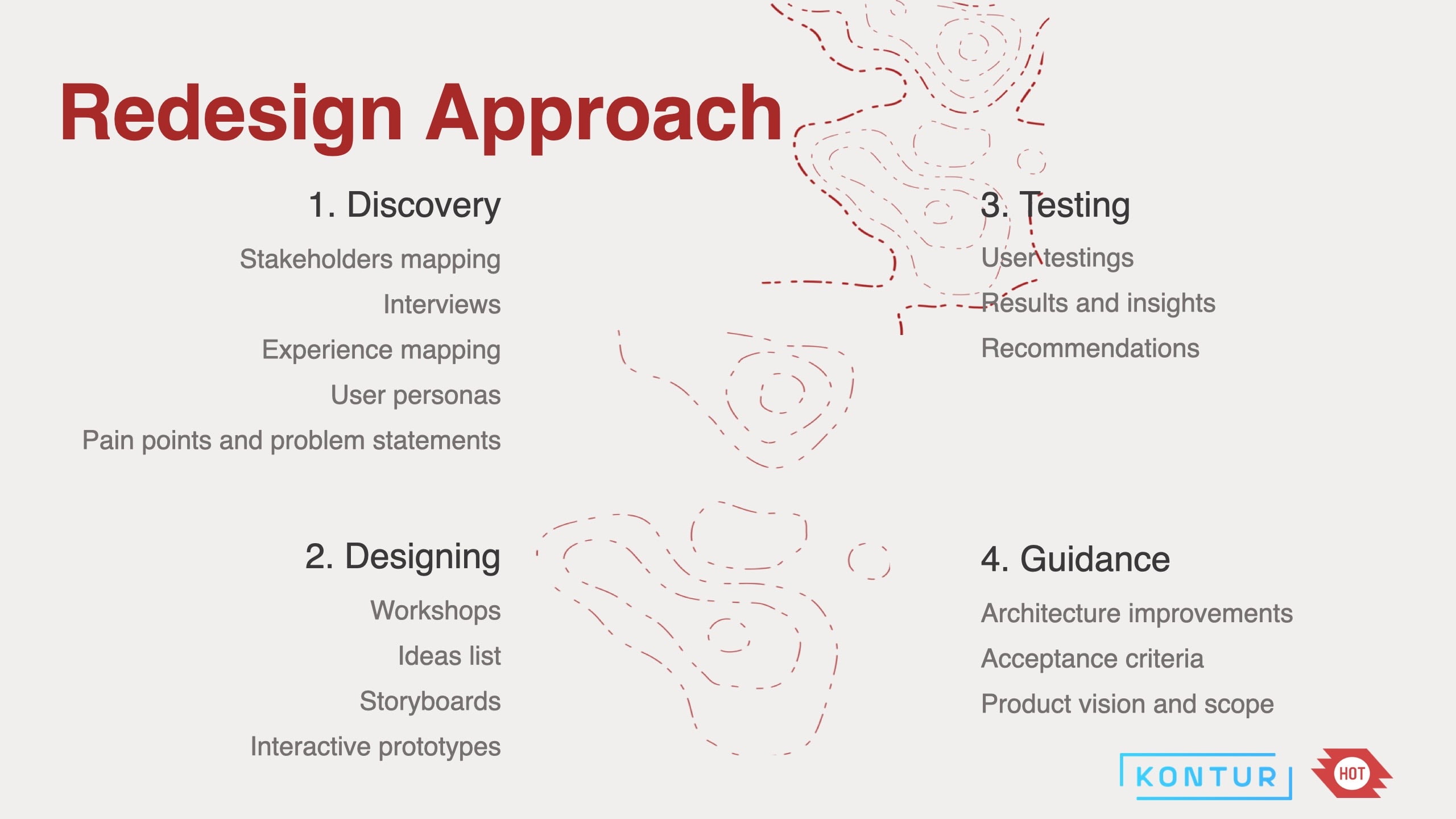
In the OpenAerialMap redesign initiative, we generally followed the design thinking process of empathizing, defining, ideating, prototyping, and testing. Thus, the project naturally progressed along four phases defined by the scope agreement: discovery, designing, testing, and guidance (see the outline below). Let us tell you a bit about how the project developed through each stage and how it benefitted from applying a product mindset.
Discovery and designing
Before designing new features and systems architecture, it is vital to understand the customer’s needs. Thus, we created a stakeholder map with nine intersecting stakeholder groups and their representative organizations. Then, we defined three user personas that would be relevant in the context of OpenAerialMap redesign: mapping project manager, imagery contributor, and GIS analyst. The personas are imaginary users representing a product’s target audience.
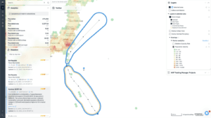
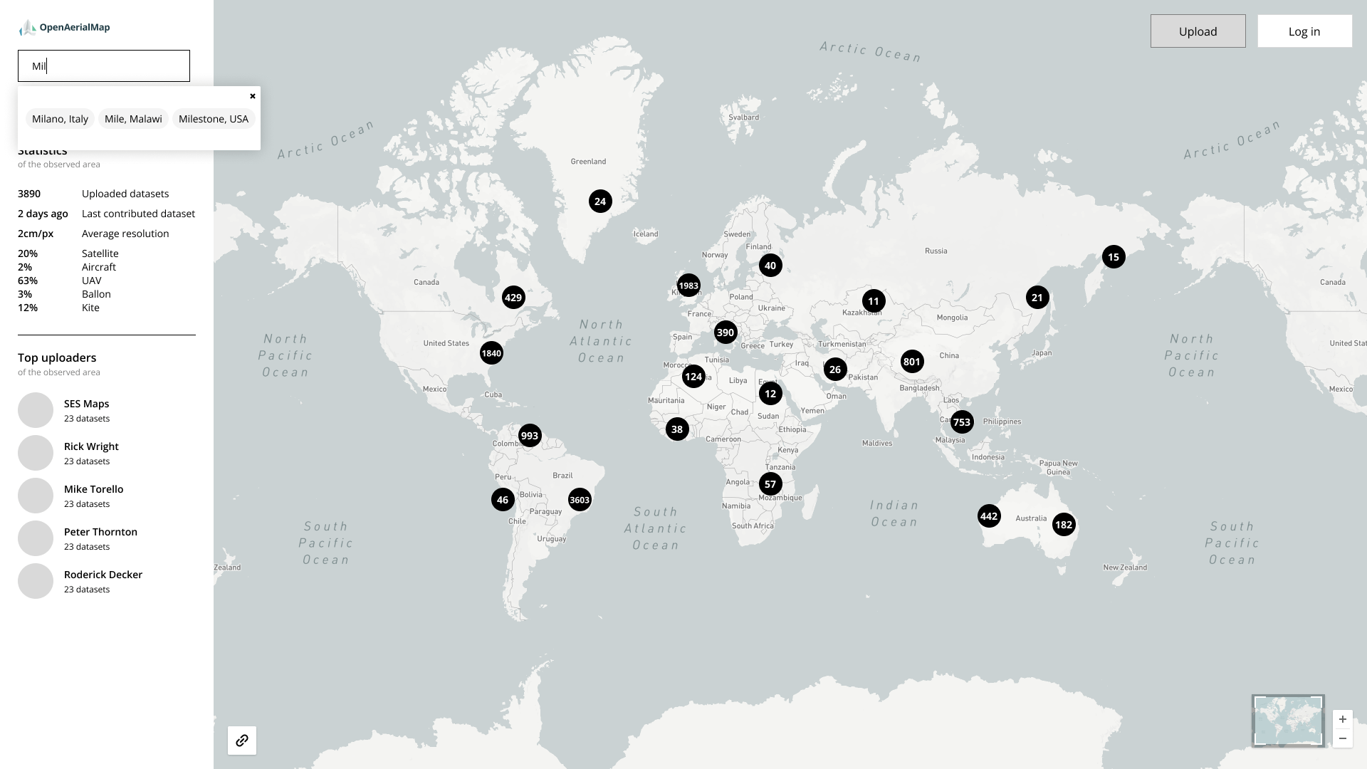
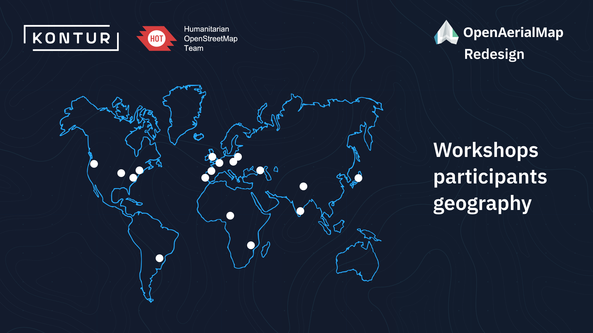
For each persona, we identified their needs and the pain points they face in the current user flows. Several workshops took place with the involvement of participants representing 13 organizations and community groups worldwide (see the participant map below).
Next, we generated possible solutions for the three personas’ identified problems and presented the most viable of these in user interfaces. With prototyping tools, it is possible to create functional and interactive user interfaces that enable us to verify our assumptions about the product.
The solutions for platform users included improving the connection between the map and the side panel, image clustering to ease navigation, extending filtering and search options, log-in and account settings enhancements, and much more. We also proposed specific solutions for imagery contributors, such as improving the uploading and form-filling process.
Testing and guidance
Prototyping allows us to quickly discover if the “look and feel” of a product or its features meet the expectations of a test group. During the testing phase, we conducted five sessions based on Figma prototypes with representatives from different stakeholder groups. While the users interacted with various scenarios, the team checked their design hypotheses and gathered feedback and insights.
Not all product requirements are of equal importance to the users. Thus, we have developed acceptance criteria based on collected user stories and ordered them on a prioritization scale from ‘Must’ to ‘Should’ and ‘Could.’
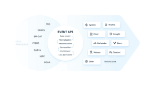
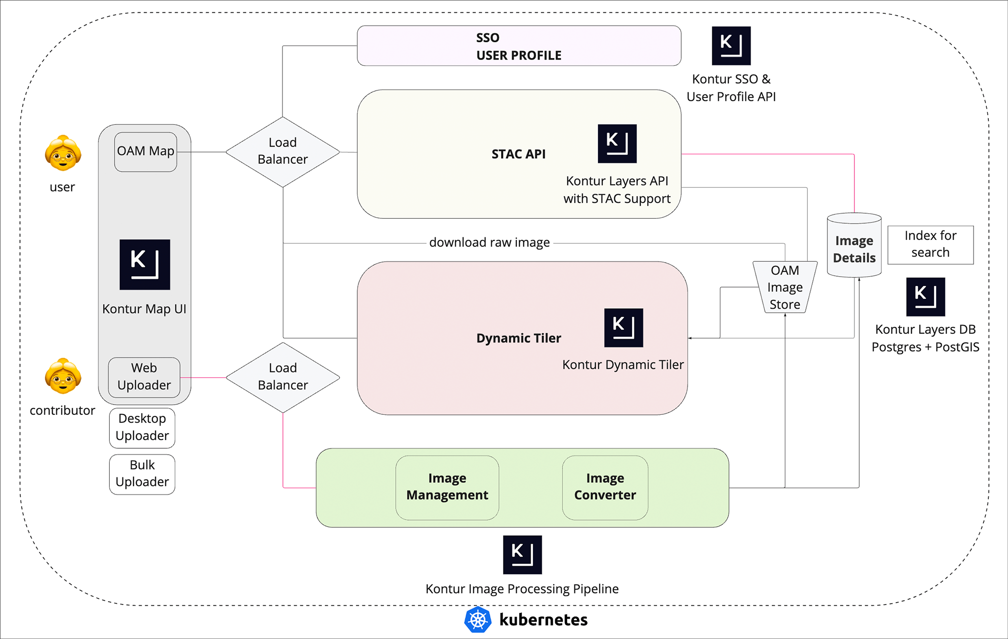
Implementing the proposed improvements also requires changes in the current OpenAerialMap architecture. As a result of extensive research involving technical specialists, we offered three possible approaches to the new architecture: (1) based on open-source solutions, (2) using proprietary AWS modules and services, and (3) utilizing Kontur’s existing capabilities. An additional option covered just minimal changes to fulfill user needs.
Among Kontur’s capabilities, the following elements can be valuable for development projects, such as the redesign of OpenAerialMap (see the architecture diagram below):
- the user interface for interacting with users of the map (Kontur Map UI);
- the single sign-on and user profile API for the user management system;
- the layers database and API for storage of imagery metadata;
- the image processing pipeline and dynamic tiler for image management.
A product vision is one crucial element of a product-focused approach that helps us understand the purpose of what we are producing and clarify the expected experience from a user’s interaction with a product. For OpenAerialMap, we formulated three connected vision strategies according to the stakeholder group:
1. For imagery users who want to find new images, OpenAerialMap is a free resource that stores high-quality imagery data for downloading and sharing.
2. For imagery contributors who want to store their imagery data, OpenAerialMap is a free displaying storage place that provides an easy and understandable way of uploading and sharing their data globally. It allows anyone, from drone pilots to satellite companies, to contribute their imagery and make it available with an open license.
3. For mapping project managers who need a way to host open imagery for tracing it accurately and up to date in OpenStreetMap (OSM), OpenAerialMap is an open-source web platform that allows convenient uploading and streaming of imagery tiles directly in OSM editors.
Finally, we described our vision for the future OpenAerialMap development project with the requirements for each phase, proposed the scope, and estimated the timing for developing a minimum viable product (MVP). An MVP release is necessary to evaluate users’ reactions and feedback early and avoid unnecessary work in product development.
As a result, we have provided HOT with thoroughly documented guidance to develop the improved version of OpenAerialMap. With our passion for open-source tools, we believe the redesigned platform will better support humanitarian project needs in the future.