Atlas login
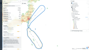
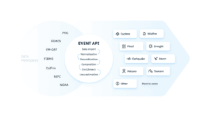
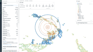
When you open Disaster Ninja, the first thing you notice is real-time visualization of natural disasters — earthquakes, floods, hurricanes — all shown with their estimated impact zones. But what many don’t realize is that Disaster Ninja is also a powerful tool for assessing data quality.The challenge: can we trust population data?
One of the most critical indicators in disaster response is population data. How many people live in the affected area? This question is essential for humanitarian organizations, rescue teams, and decision-makers — but it’s surprisingly hard to answer accurately.
Censuses are conducted infrequently — once every 5 to 10 years. Some datasets estimate population based on building footprints; others use mobile phone signals. The results can vary dramatically between sources.
To address this, we built our own global dataset — Kontur Population. We regularly update and benchmark our data against other sources to detect discrepancies.
Kontur population density
Coverage: Global
Update: Daily
Self-developed accurate population dataset. Enables site selection analysis, smart city solutions, and disaster management by providing global population density information. Read full article
For business
If you require custom processing or a higher-resolution version of this dataset.
For GIS developers
You can use this dataset mapped to 400m H3 hexagons for free to elevate your projects.
For non-developers
Subscribe to Atlas to access to this and many other layers using our platform without your own development.
You can also use datasets separately for different countries, for example: United States, United Kingdom, Canada, India, Australia
How Disaster Ninja helps
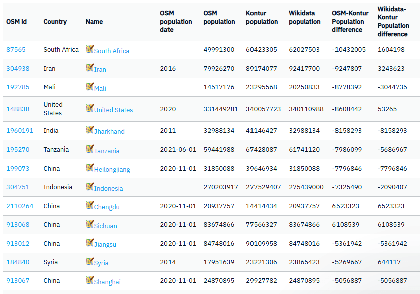
One way we do this is through population tag checks. For example, we compare administrative boundary population tags in OpenStreetMap with our own data. Significant differences between the two often indicate potential inaccuracies in OpenStreetMap — or highlight areas where our own data can improve.
If you’d like to contribute to improving OpenStreetMap data, you can open specific areas directly in JOSM (a popular open-source OSM editor) using remote control. It’s a great way to help make global data more reliable and impactful.